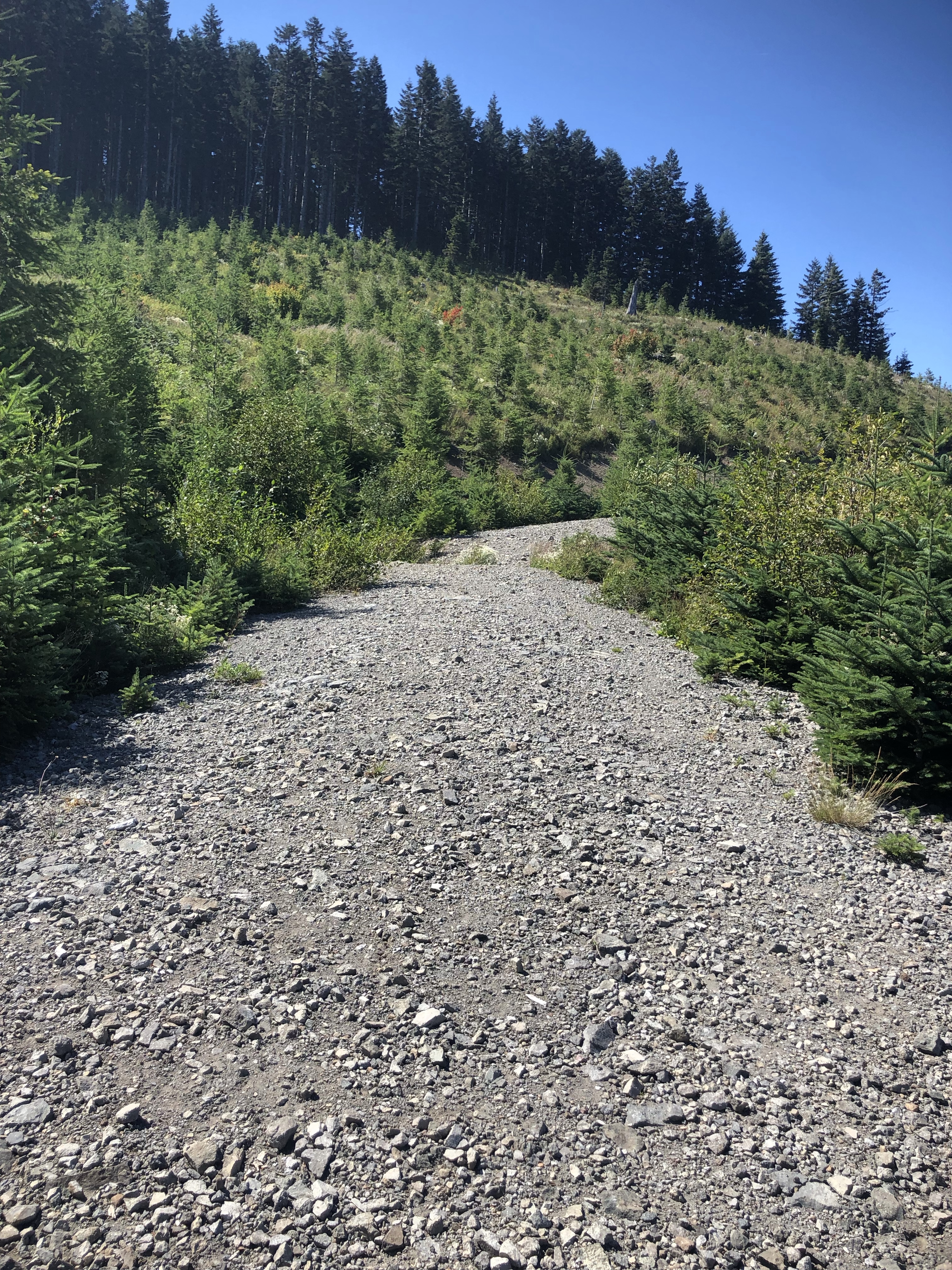
This is a great spot that's not too hard to get to and you can overnight it pretty easily. You'll drive on gravel to get there, the climb will feel pretty steep as you fumble over lots of loose gravel, but the reward is worth it. We parked at Grouse Vista Trailhead.

This was our first backpacking trip and I can honestly say this was a great destination for our first time, just mommy and daughter. We laughed, loved, planned to see stars through our brand new netted tent, and learned a lot!!! We cried once and ate everything we packed… we also drank everything we brought before we even reached the top… but there’s more on that later. To sum up our adventure:
- we enjoyed lunch by a waterfall and took a dip
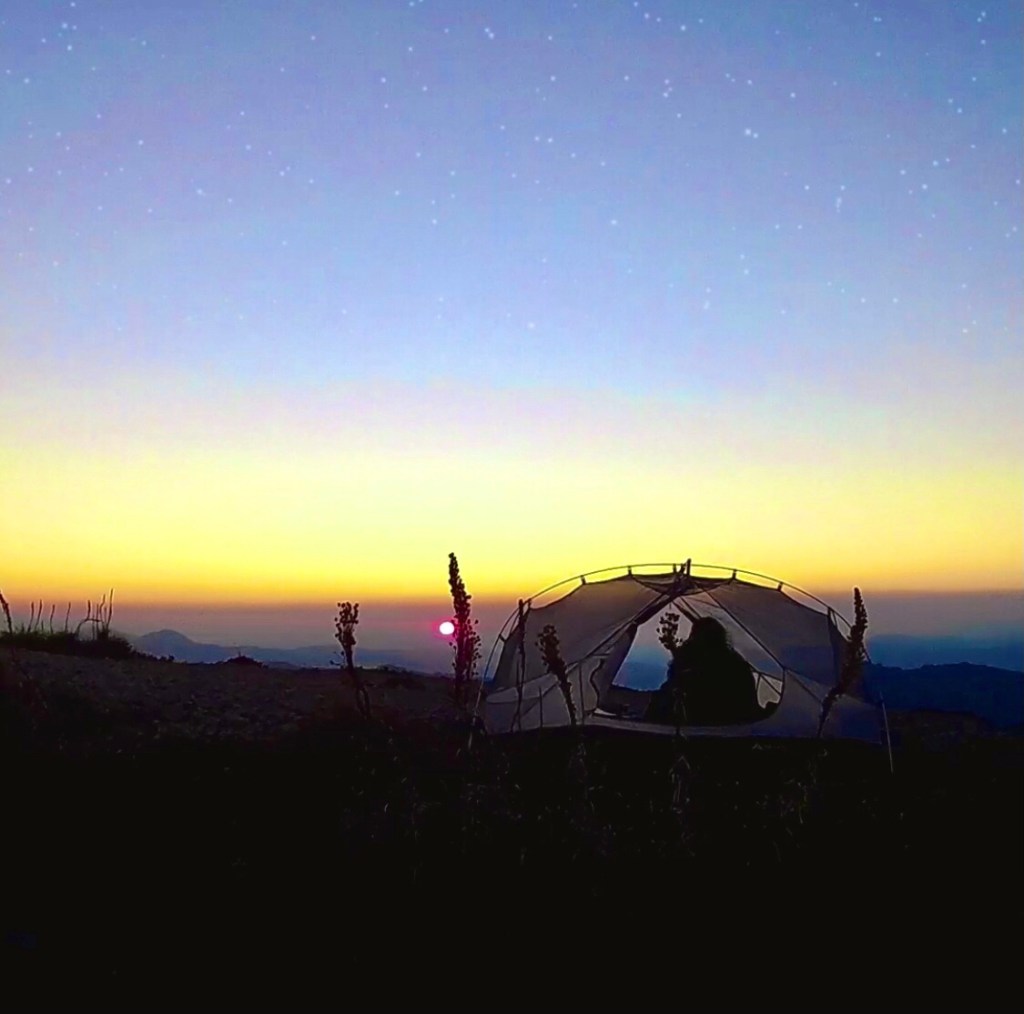
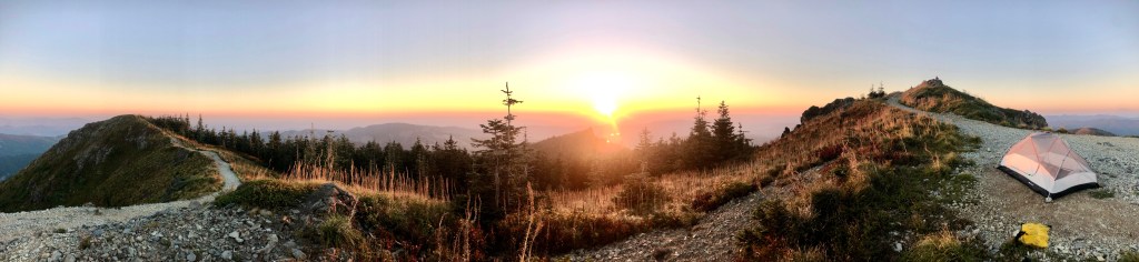
- we camped right on the summit
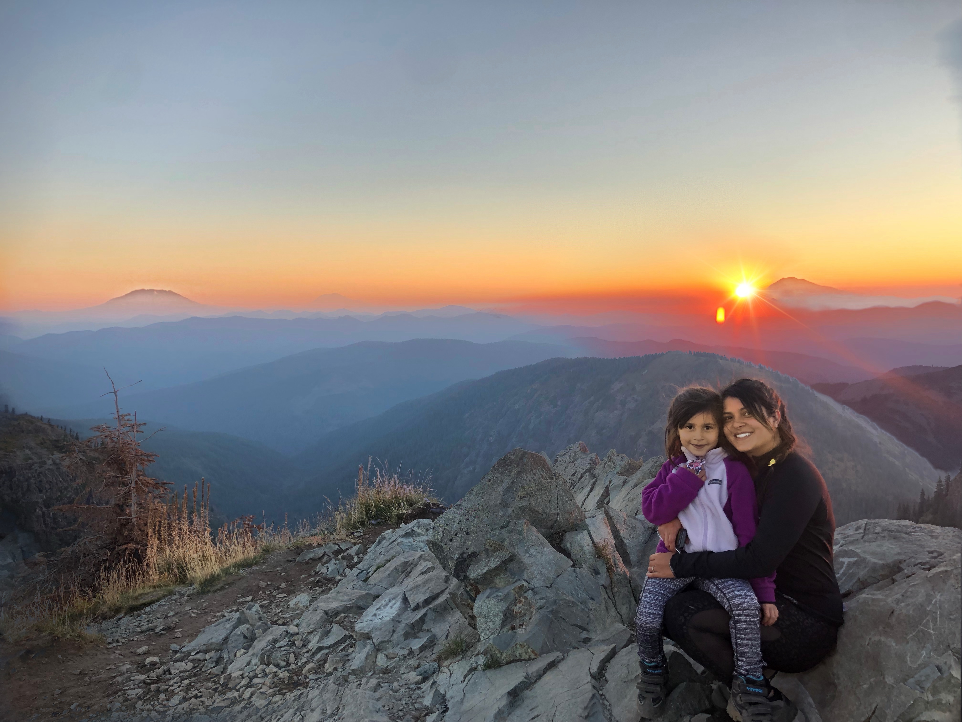
- we could see multiple mountains from summit: Rainier, Adams, St Helens, Hood, and Jefferson
- we ate dinner while the sun set
- we star gazed through our tent and drew our own constellations (for five minutes because she fell asleep from exhaustion)
- we ate breakfast while watching the sun rise
If you want to jump ahead:

some panoramic views of the summit and our tent
Getting to the Trail
Here is the USDA website about this trail for current information: https://www.fs.usda.gov/recarea/giffordpinchot/recarea/?recid=31634
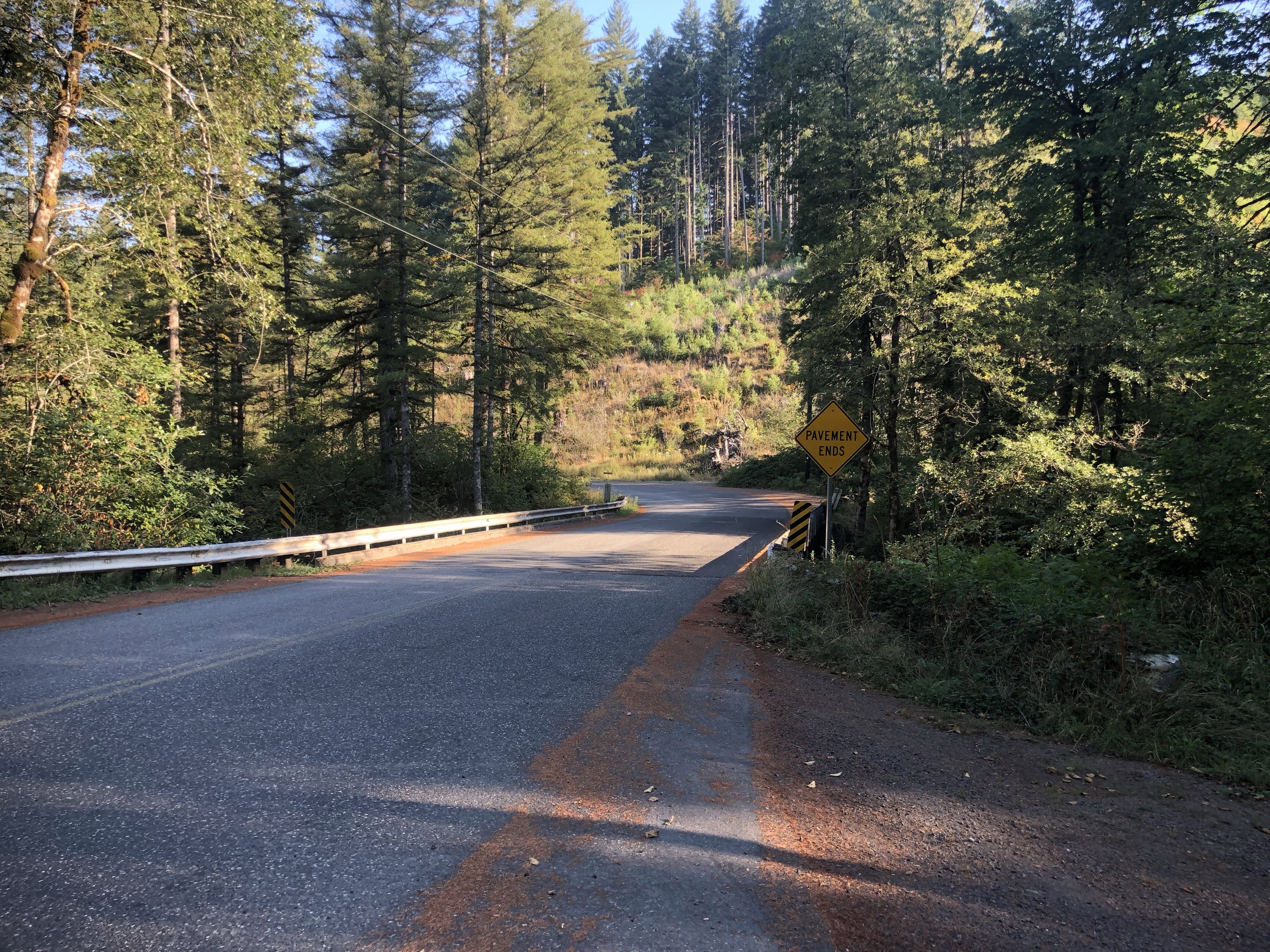
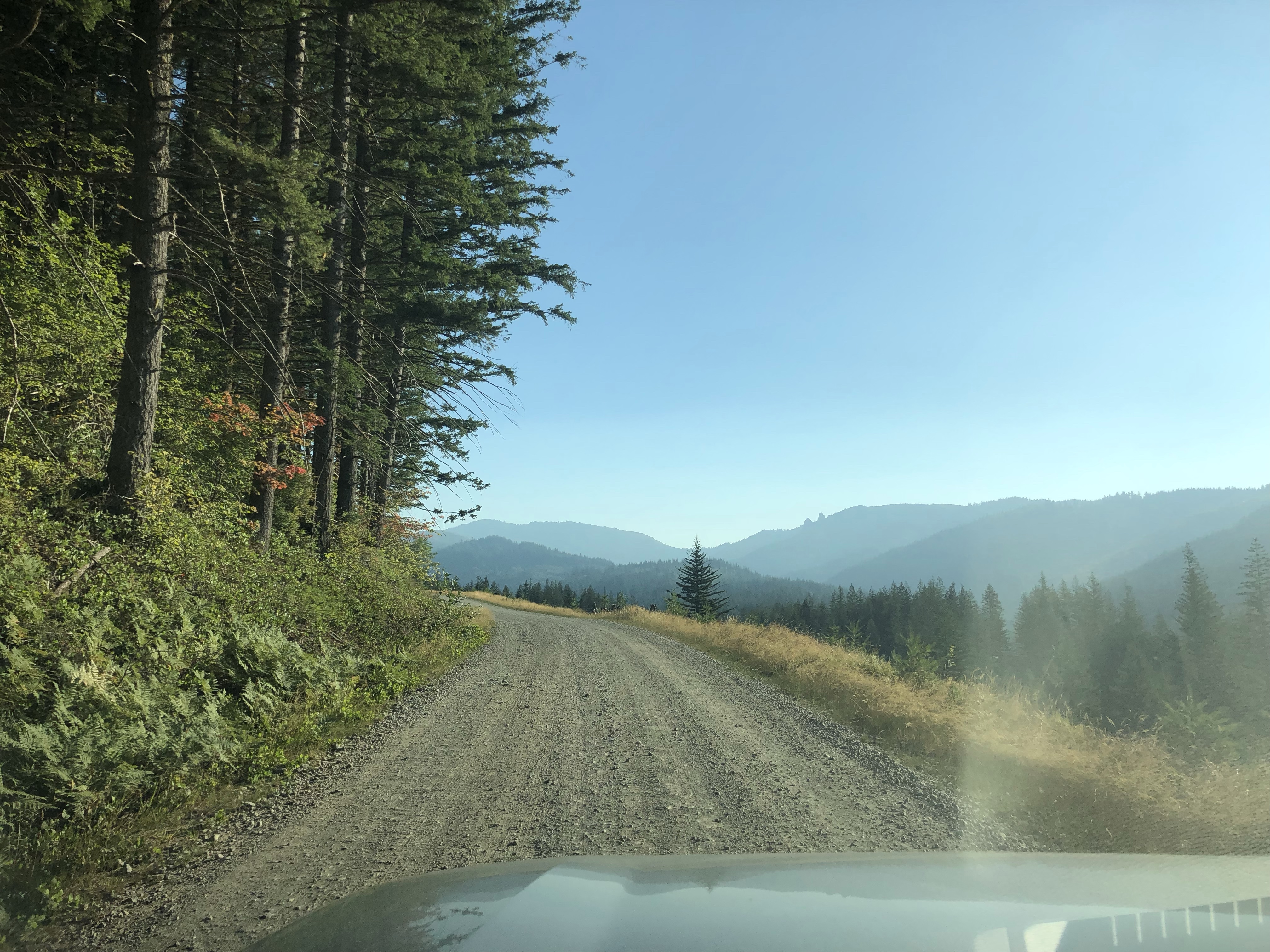
The Road There: is gravel. At first it’s paved but then you cross a bridge and it turns into gravel. There are some dips and some quick corners, a couple bridges, and some narrow areas (so I suggest taking it slow). It can get a little rocky in a few spots, high clearance isn’t required but it’s suggested.
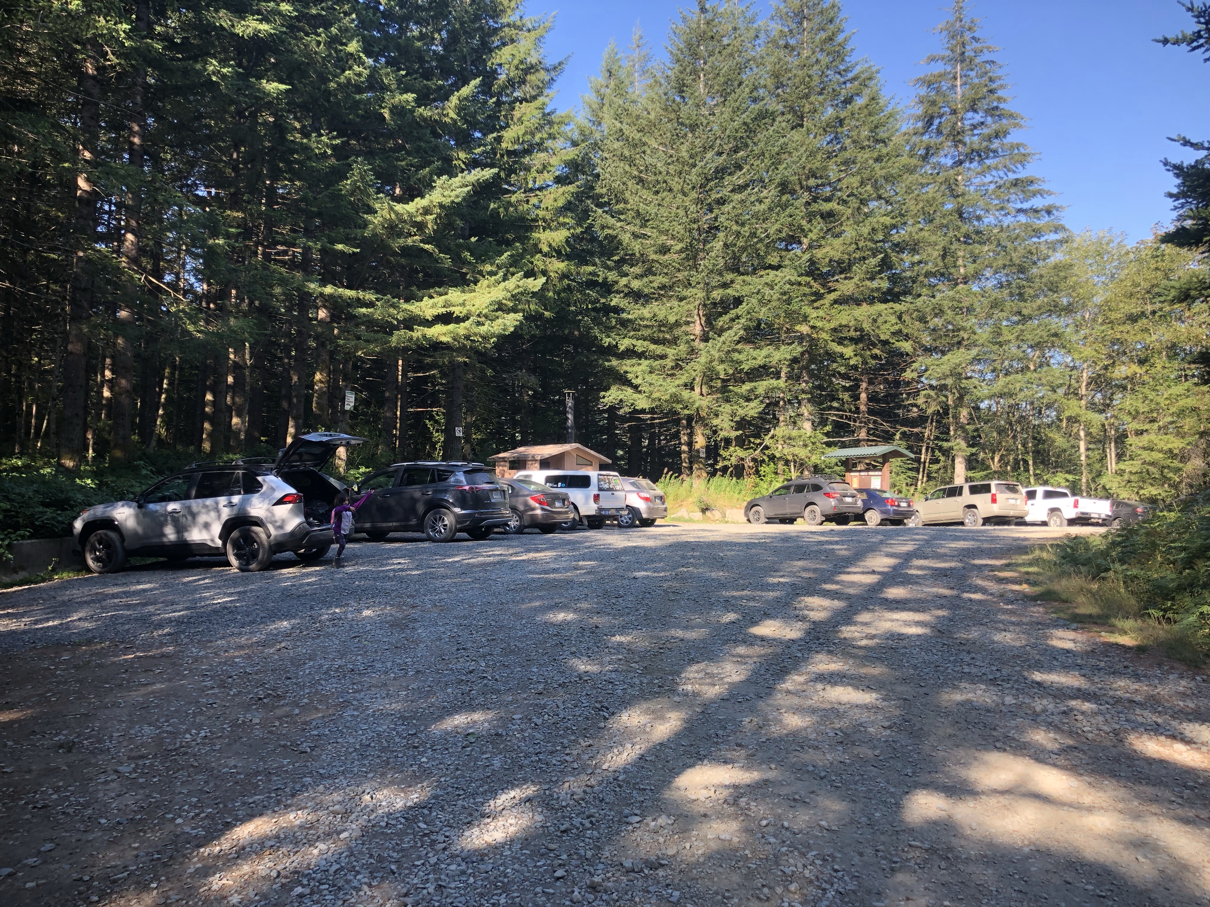
The Trailhead/Parking: is great! It’s a decent size turn-out area with no marked parking lines and a good information board. There is also a vault toilet! Make sure you have the correct pass (go to the USDA site for current info on the needed pass, link above). We had no issues parking there overnight. Remember to always practice not leaving anything visible in your car for thieves, I hear horror stories all the time…
Start of trail: across the street from the toilet. The trail that goes by the toilet goes to a campsite the opposite direction from summit.
Trail Options and Specs:
I am going to describe the route we took on this trip and break it up into some other route options so you can pick the right adventure for your trip. Honestly, I thought I did excellent research prior to going, but it turned out to be one of those trails you have to experience to get the whole picture, plus we didn’t go straight to summit, we looked around a lot.
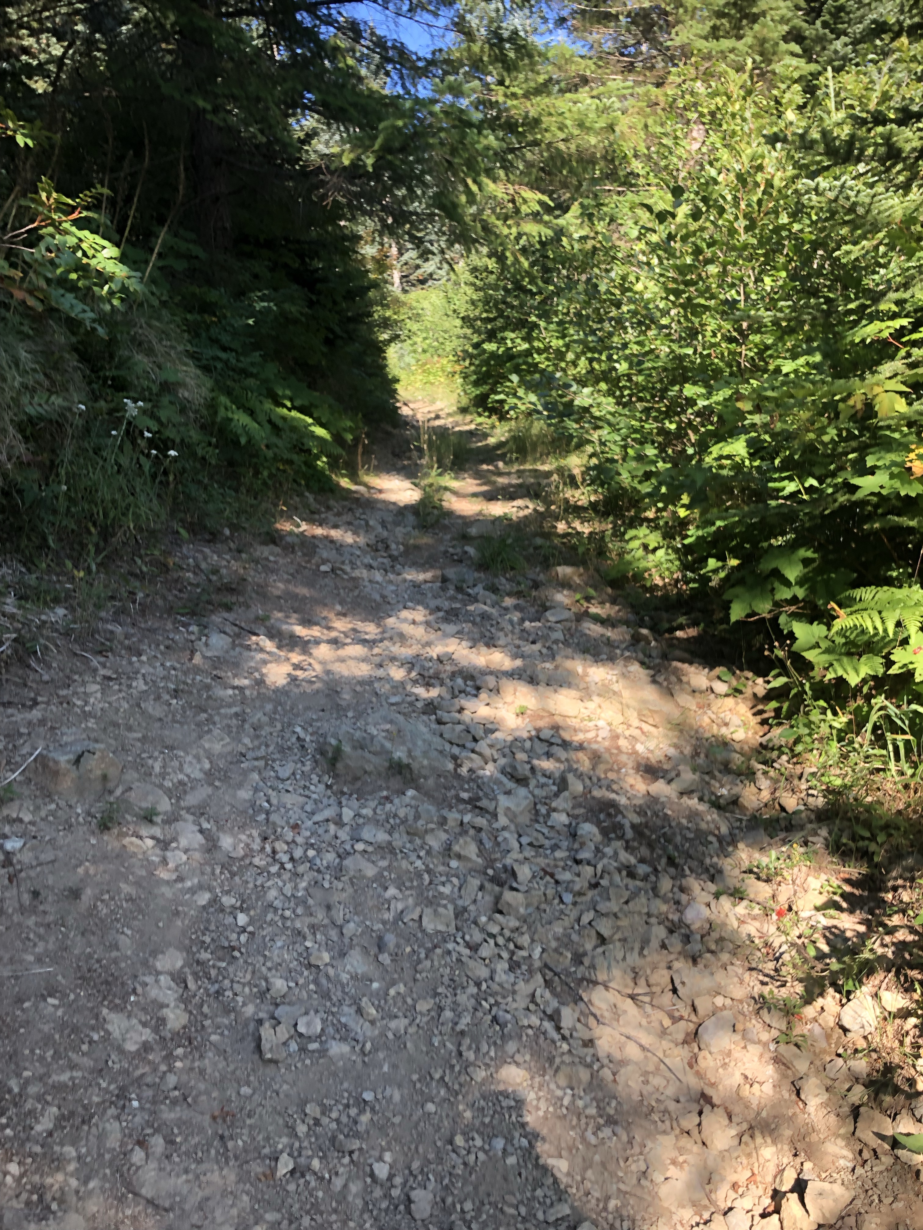
All of these routes have a few things in common: there is minimal to no water access while you’re out there, it is mostly gravel and rocks of all sizes, you will absolutely notice the incline/decline, and be prepared to be exposed to the sun a lot while out there (bugs if it’s summer).
The images used for my trail descriptions are screenshots from AllTrails of the area I’m describing. Also, here is a good detailed map of the trails in that area for printing (Sturgeon Trail is around where Silver Road is on this map – could be the same thing but I haven’t confirmed this): https://www.dnr.wa.gov/Publications/eng_rms_tarbell_06_full.pdf

Grouse Vista Direct to Summit (Out and Back):
- Round-Trip about 6.5 miles
- 2100′ elevation gain
- starts with lots of tree cover then becomes exposed
- No water access (rumor: there is a spring near the summit)
- Nice and direct with a steady incline/decline the whole way
- The trail to Pyramid rock splits from this trail

Sturgeon Rock to Summit Loop:
- about 10 miles + 2600′ elevation gain
- Lots of sun exposure on Tarbell, shade on Sturgeon with some downed trees in the way, Grouse Vista is a mix of both
- You will cross one creek on Tarbell, otherwise access to water is minimal to nonexistent
- Sturgeon Rock is accessible via split off from this trail
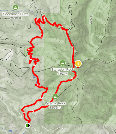
Chinook to Summit Loop (Hidden Falls):
- about 16 miles + 4010′ elevation gain
- Lots of sun exposure on Tarbell with woods when you get into the tree line until a ways past Hidden Falls, the ridge is exposed and slippery from gravel with steep drops, Summit is exposed, Grouse Vista is a mix of both
- Aside from the waterfall and two creeks on Tarbell there is minimal to no water access.
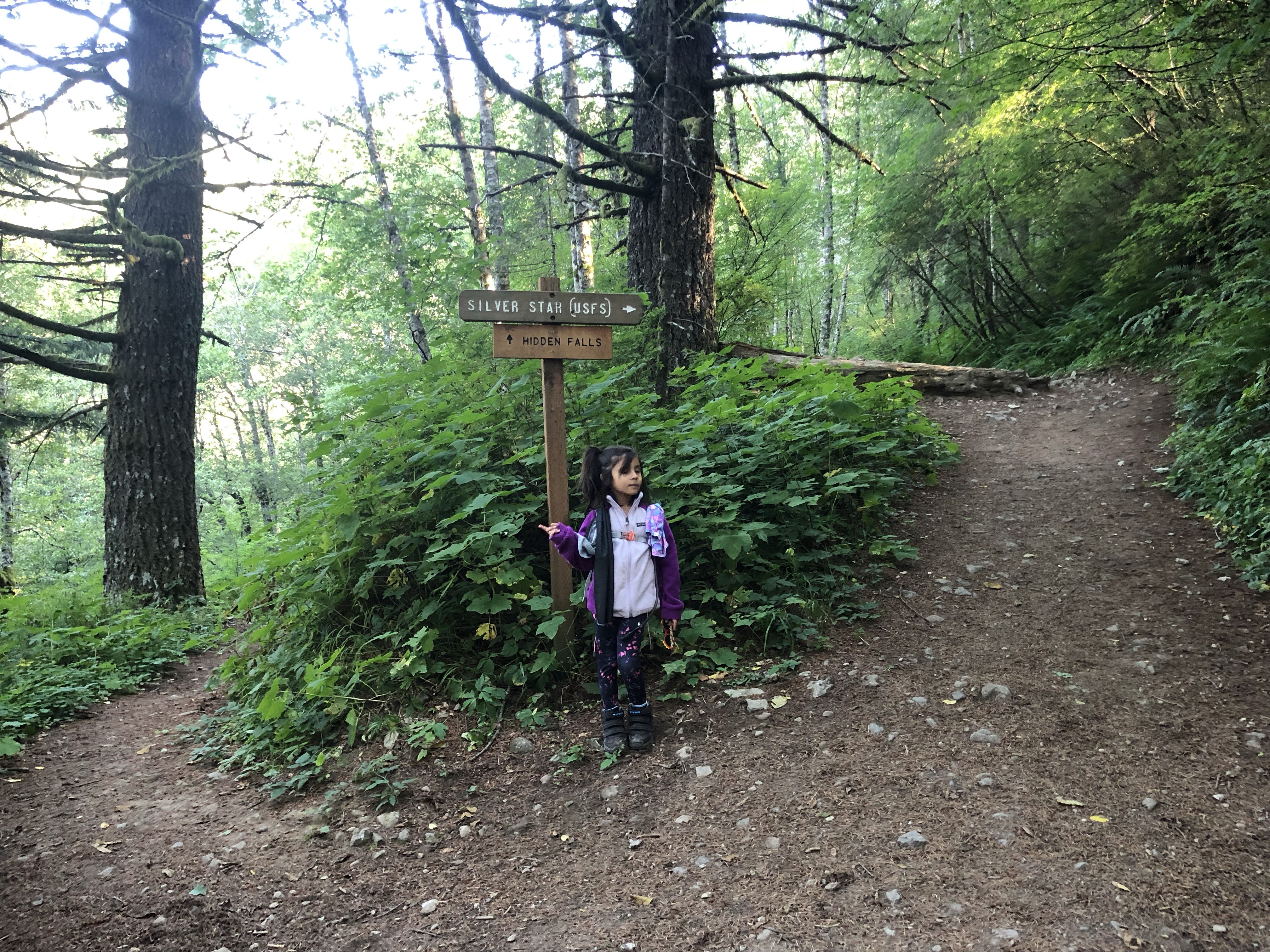
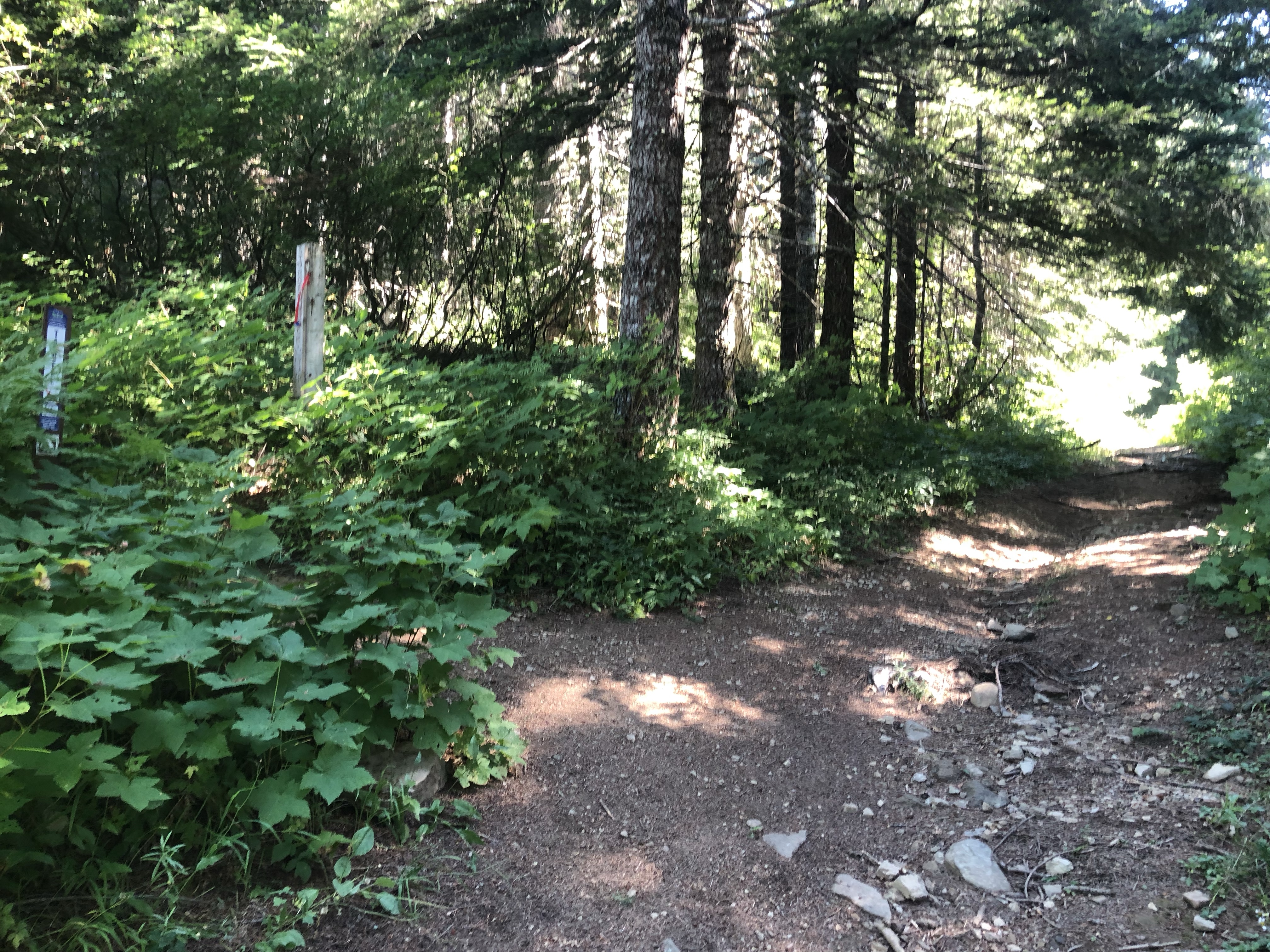
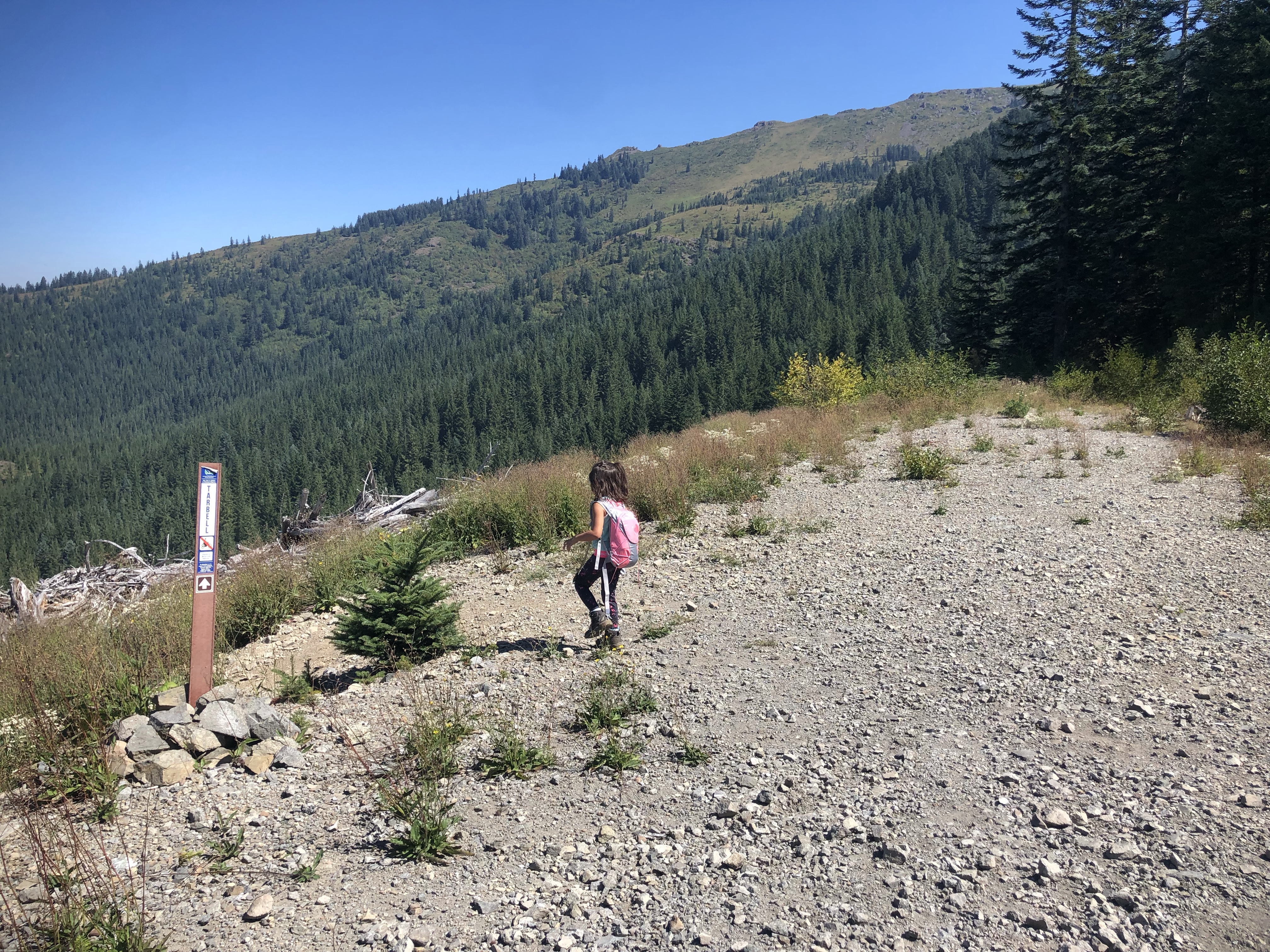
All of these routes start on the trail across the street from the toilet and parking lot. Once you’re on it, the trail splits a little ways up: go left on Tarbell if you want to go to Hidden Falls or Sturgeon Rock or Ed’s Trail, go right if you just want to summit and/or see Pyramid Rock.
If you take Tarbell there are spots that cross over a gravel road, just look for the trail on the other side (at one place there is a phallic mushroom shaped log across the way that’ll let you know you’re on the right path). There is decent signage on the Tarbell trail in the form of mile markers so you have an idea of how far you’ve gone and confirms you’re going the right way (it’s needed), however, from what we saw, there weren’t any mile markers or signs along the other trails other than where it splits into other trails. I don’t think the mileage on the signs are completely accurate either… but neither is AllTrails honestly.
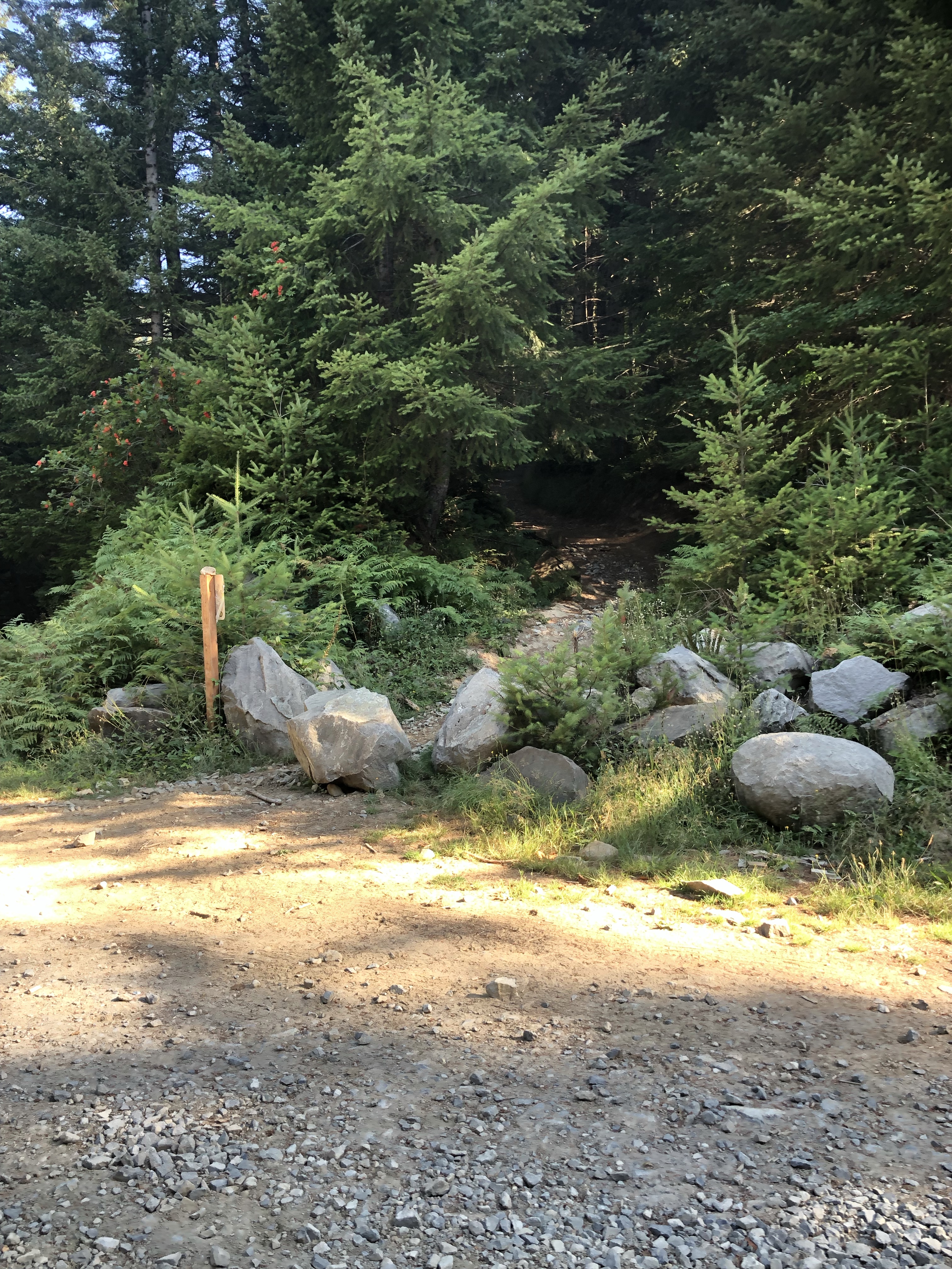
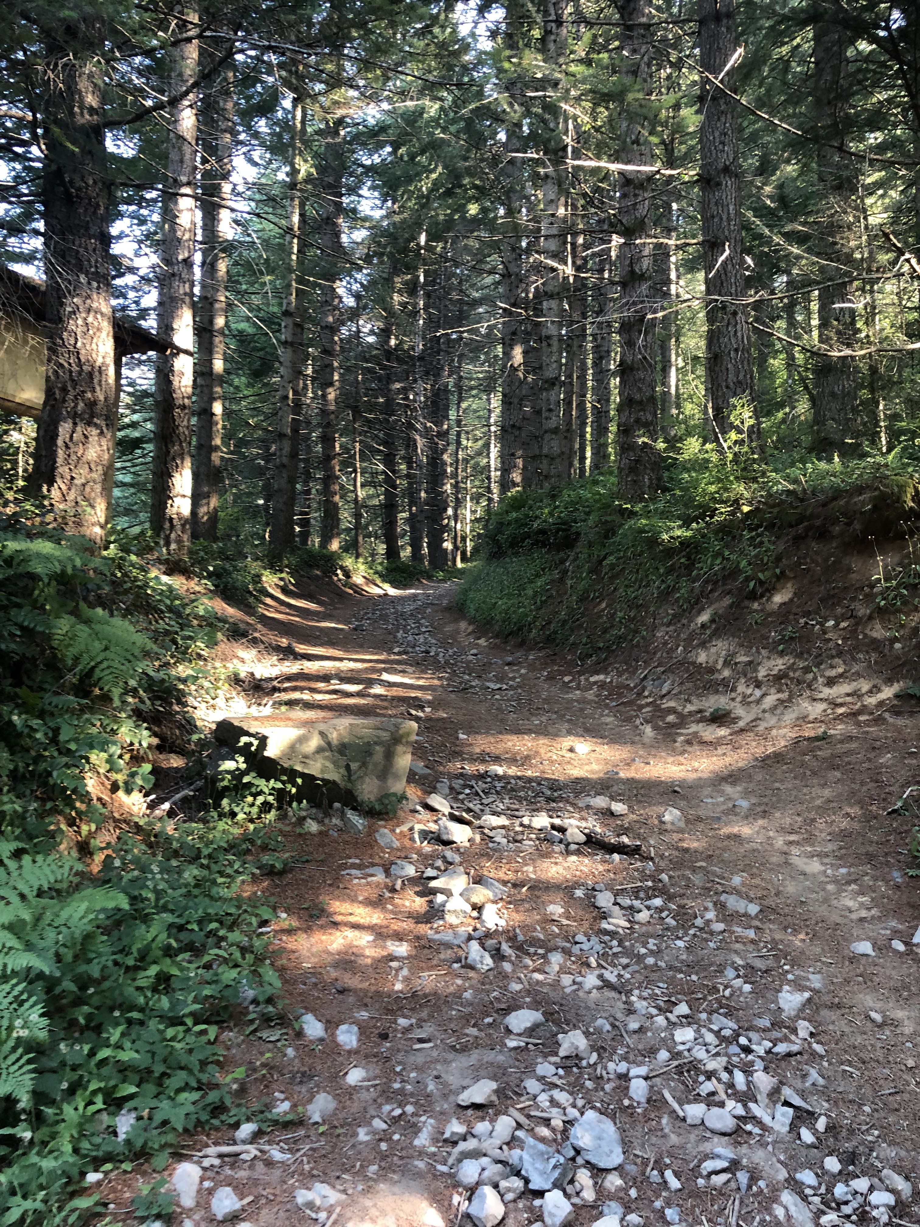
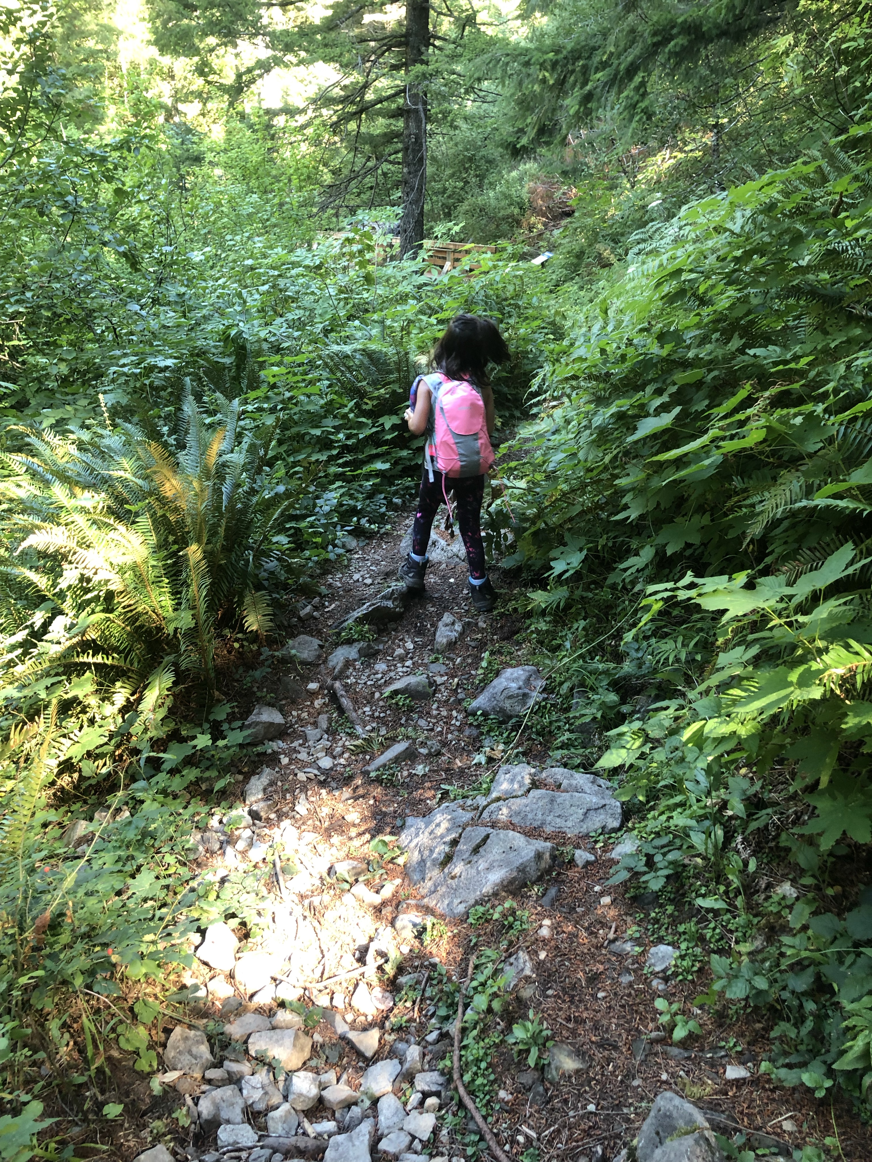
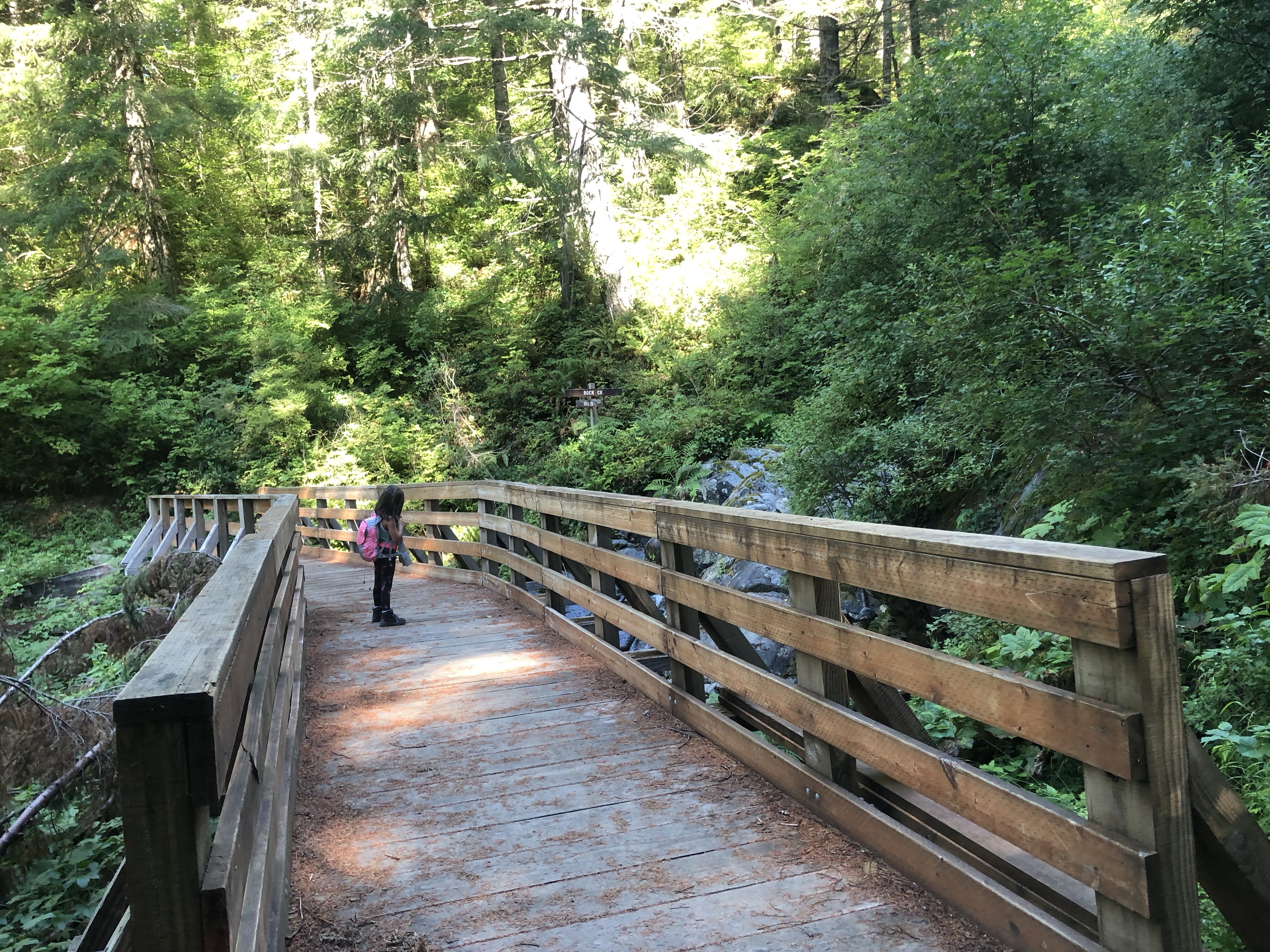
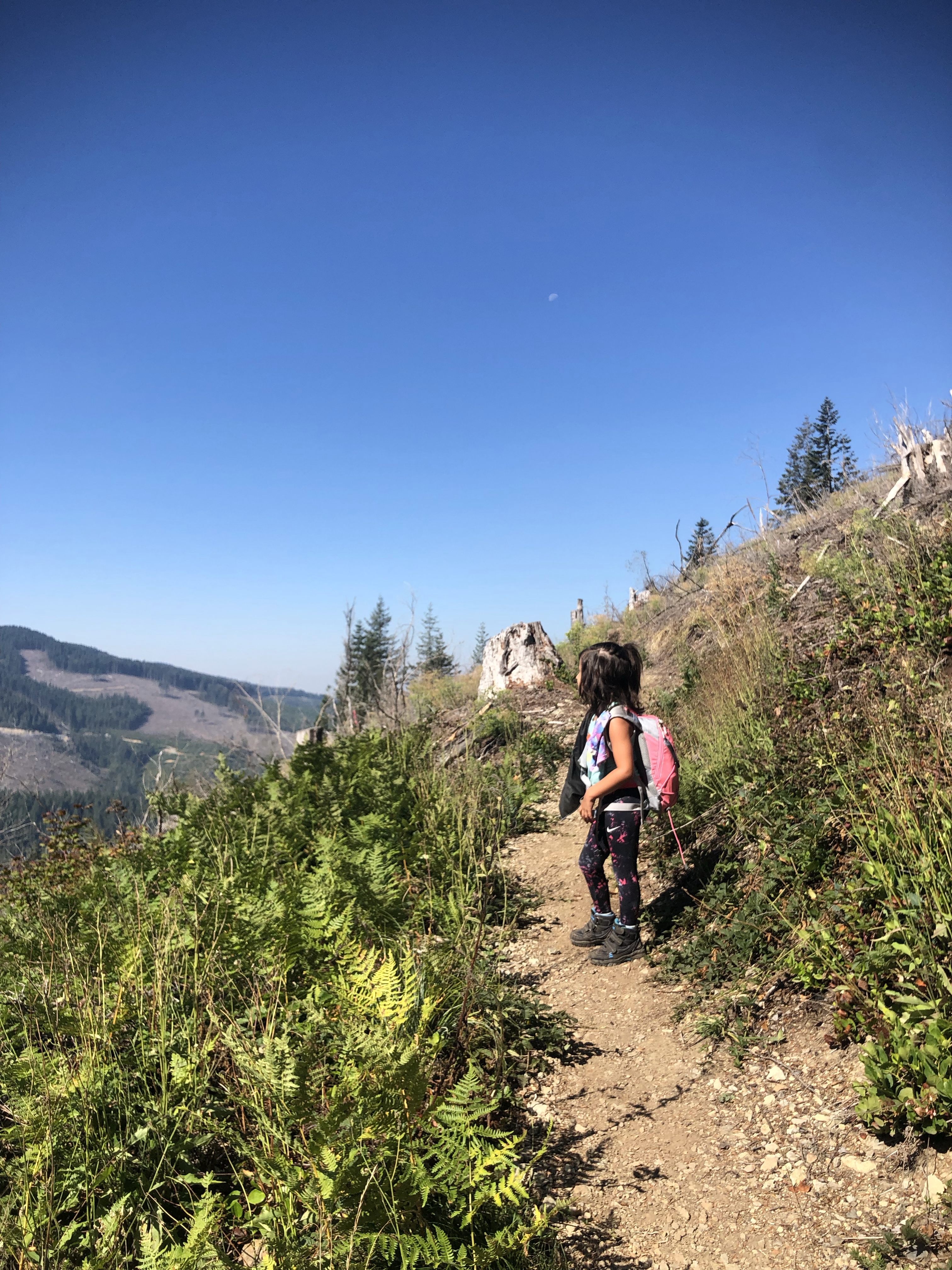
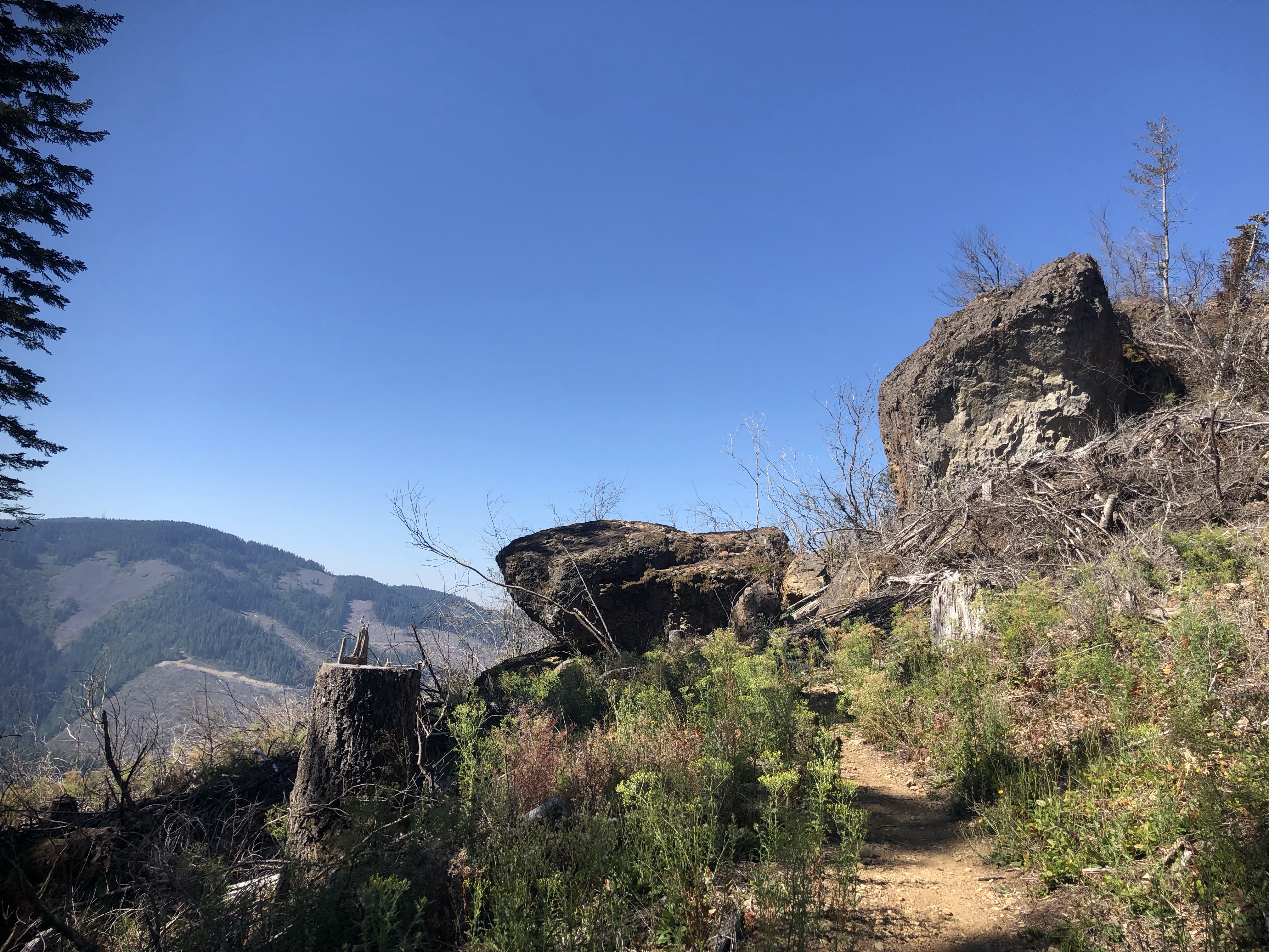
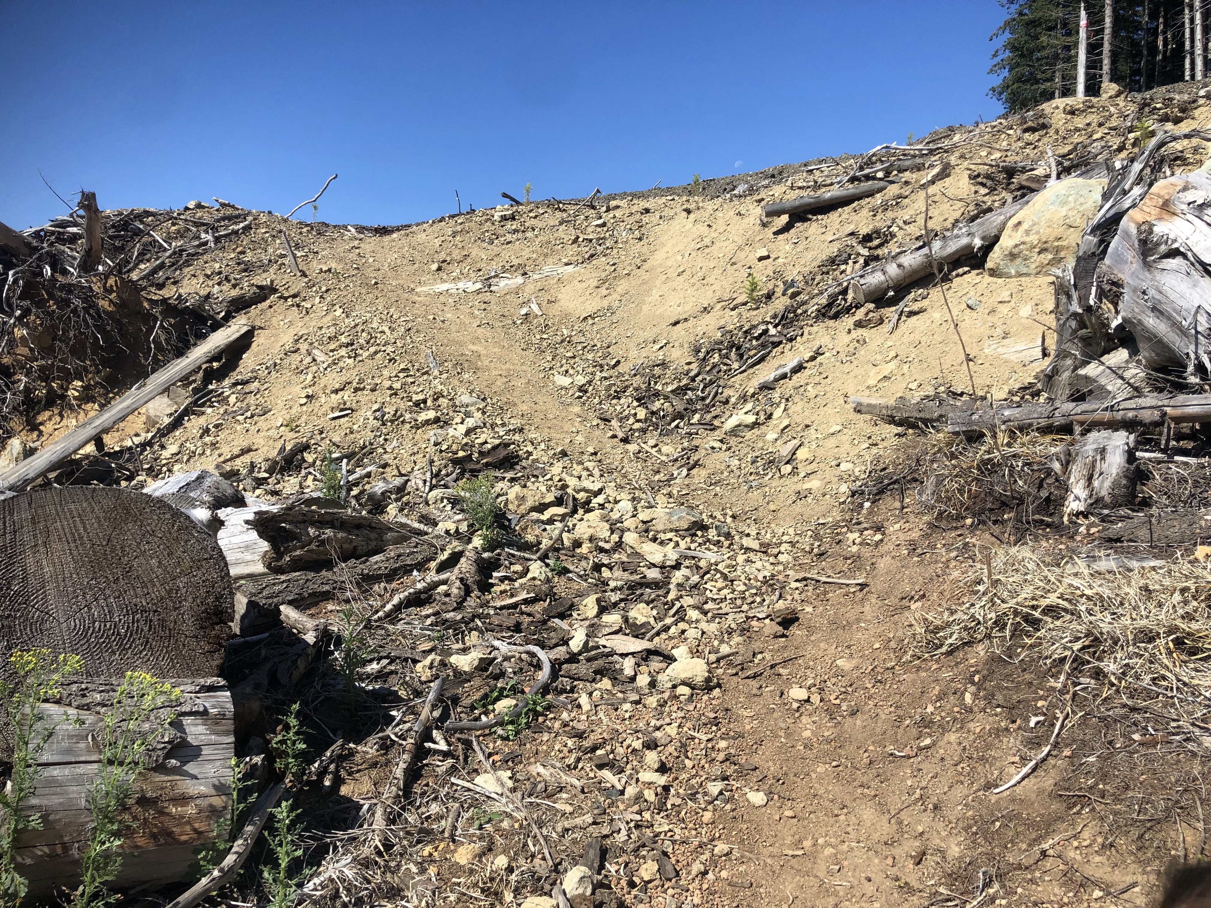
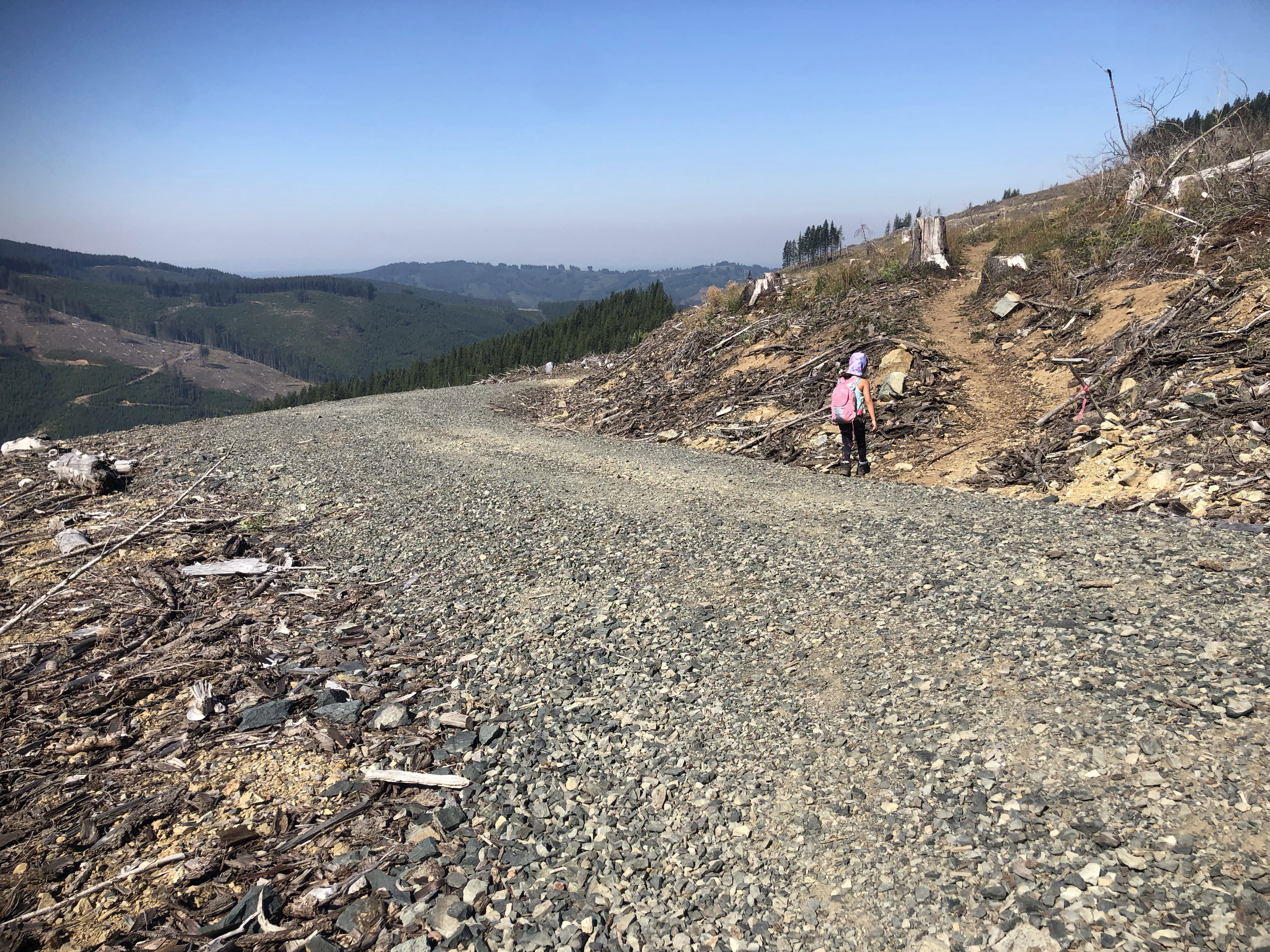
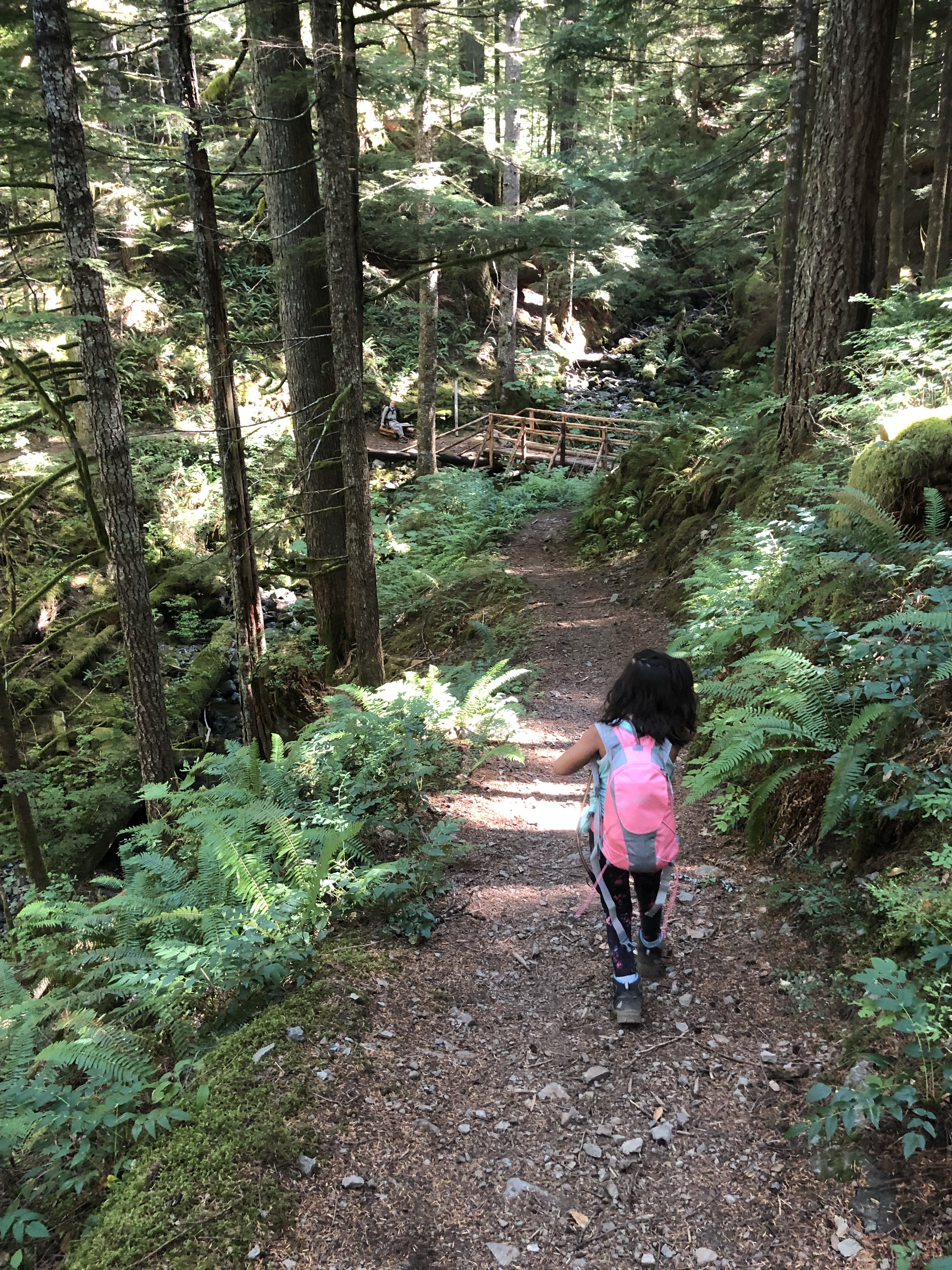
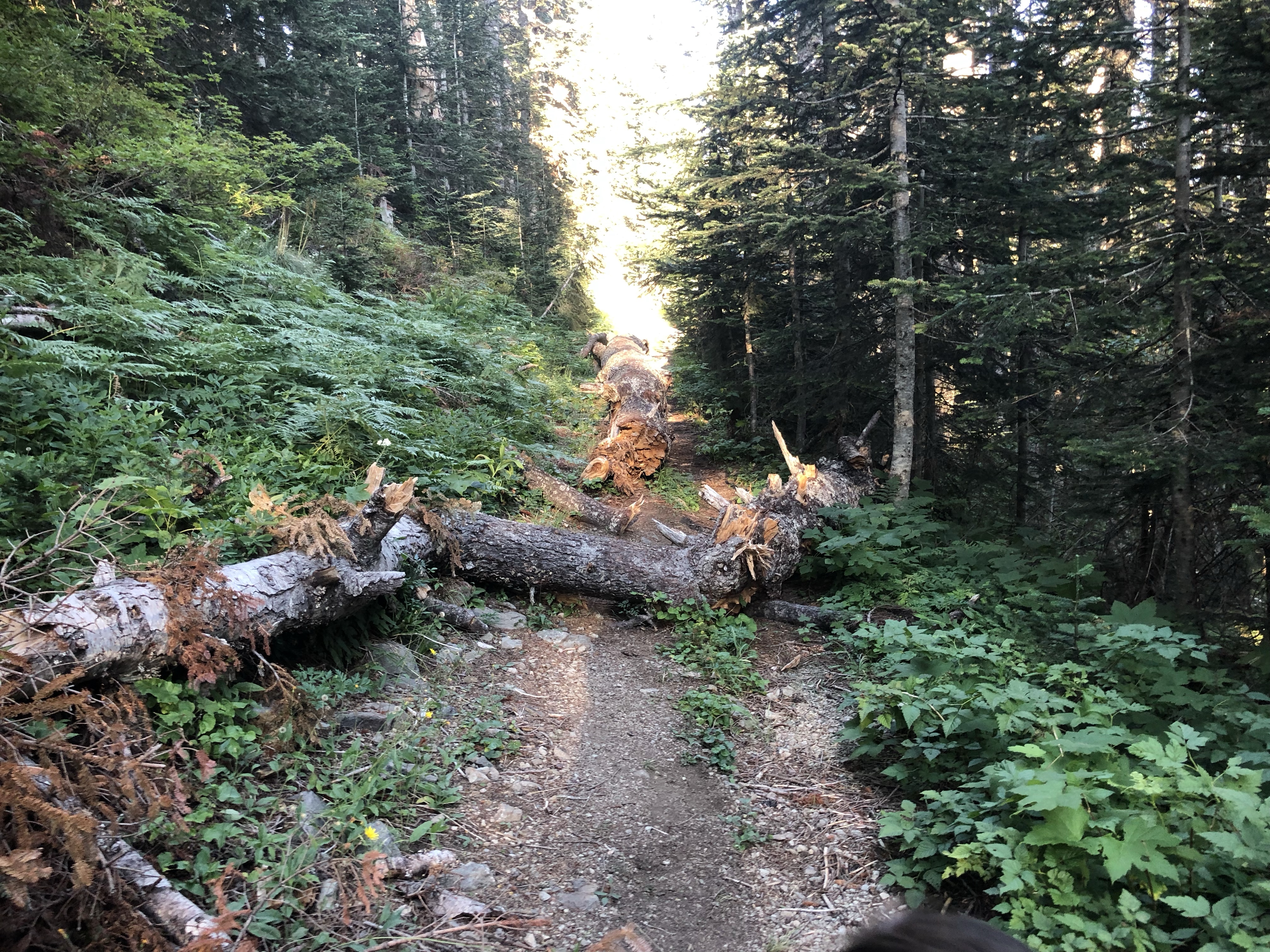
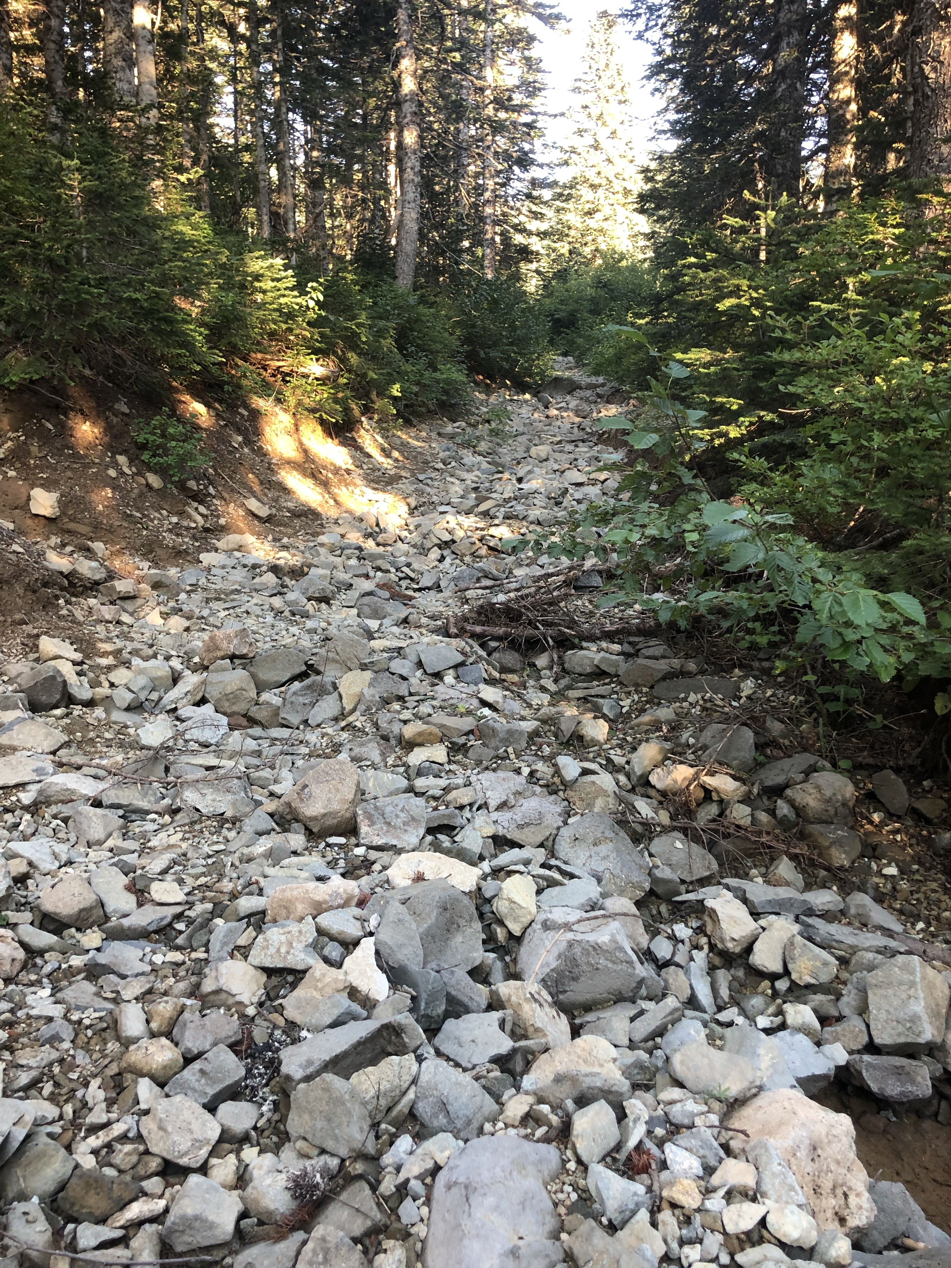
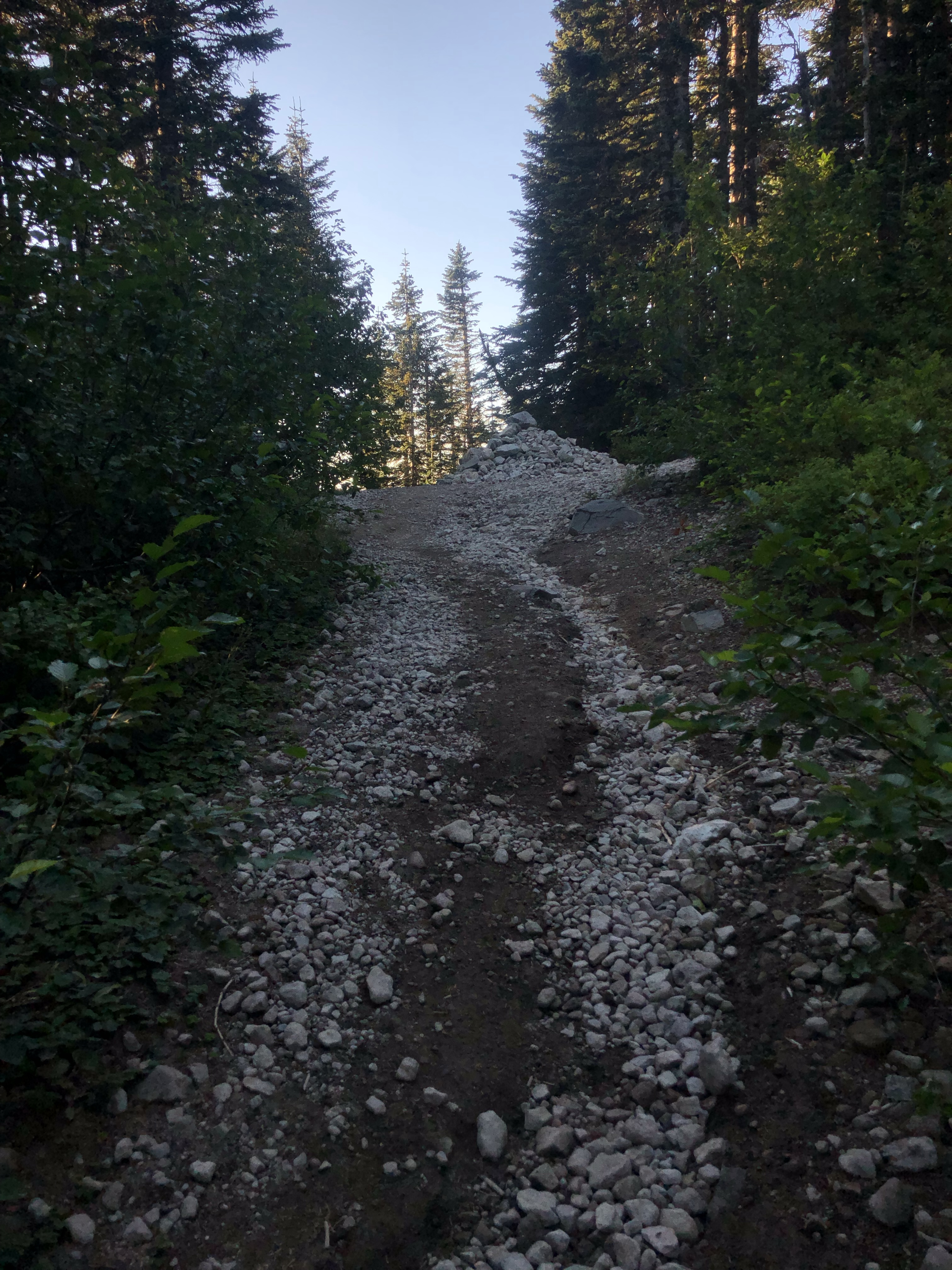
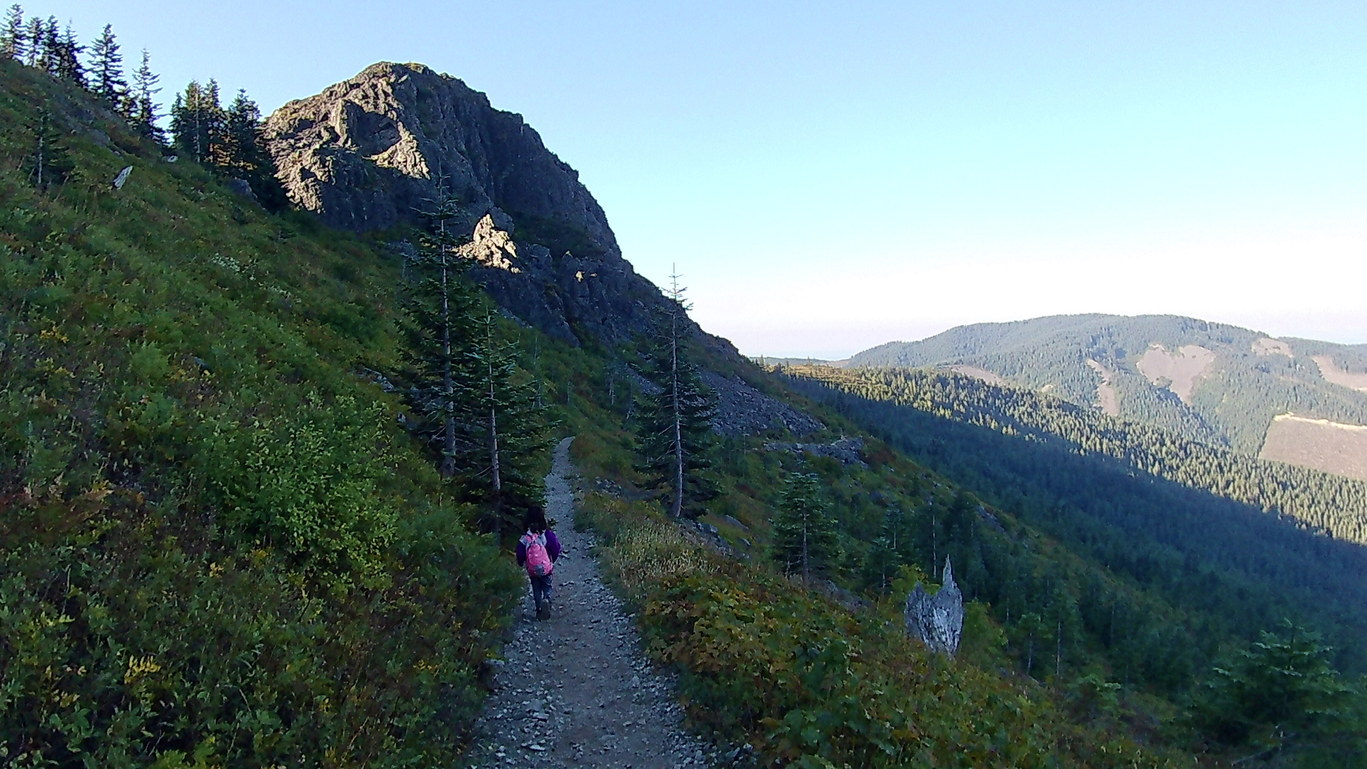
Here are some images of the trail we took, in order, going from Tarbell to Hidden Falls, then Hidden Falls to Sturgeon Rock Trail, then up to Summit, then down Grouse Vista.
Mom’s Mistakes
First mistake: We ran out of water. I assumed, since we were going to see a waterfall on this trail, there would be water and it would be fine even though I read online that you should pack in enough water. I purchased a travel sized water filter as soon as we got home. Thank you to the lovely people out there who gave us some bottled water.
Second Mistake: Taking the long route up to the ridgeline with you with very little water left. The map made it look like a very doable distance (not anything we hadn’t done before) but after all the switchbacks on loose gravel and exposure to sun, we were very exhausted by the time we reached the ridgeline. So much so, we decided to turn around instead and take Sturgeon… eesh. Lots of unnecessary walking…
Third Mistake: Letting you get into my head about wild animals. Once we were camped for the night with the cover on the tent, my mind went crazy and spiraled into worse case scenarios every time a gust of wind arose and moved the rocks around us. I was already anxious backpacking for the first time just us, but I let you get into my head so I barely slept. The sound of distant campers was reassuring, but I was still anxiety ridden all night.
Fourth Mistake: not packing enough snacks. This hike was longer and harder than I expected and you ate so much you even ate some of my sandwich. Next time I bring back-up snacks for the back up snacks.
Fifth Mistake: making it to summit for camping a little too late. All the “good spots” were taken. We still got a really cool flat spot on gravel right on the summit, but we know we got very lucky about the soft constant wind all night. It is very slim pickings for spots up there unless you don’t mind a slant or lots of gravel… remember that summits come with a lot of wind.
What I did right:
- bringing the first aid kit because you got some scrapes from slipping on the loose gravel
- bringing a mattress pad because we ended up camping on gravel
- bringing the tent rain cover because it does get very cold up there thanks to the constant wind
- bringing a large dry bag so we could seal all our animal attracting items away from camp
- packing a sleeping system designed for 2 so we could cuddle up all night instead of sleeping separate
- bringing a printed map in a ziploc so we had an idea of what trails we were looking at when we came to forks (the ziploc kept it from turning into a wad of paper or getting soaked)
- being kind and making friends with the other people we saw on the trail so we always had an idea of where to look in case we needed people (which happened)
- Leaving a treat and comfy change of clothes and shoes in the car so we could change for the ride home
Our Story
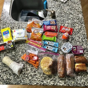
- Snacks consumed: everything in the image below, my share ended up being 1 Lara bar and a fruit leather (not including meals or summit prize)
- Meals consumed: turkey and cheddar sandwiches with a pringles. For breakfast we had blueberry ego waffles with nutella and shared a burrito.
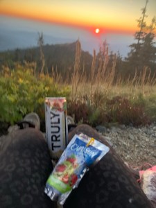
- Summit Prize: A kitkat bar for the waterfall after lunch. A kinder surprise egg for the summit
- Fun Bevs: a capri sun and a Truly
- In your bag: a 2L water bladder (full at start), all the food items in the image below with an ice pack, and the map. I like to put all the quick grab items in your bag so I don’t have to remove mine while we’re on the go. We also keep all food and garbage in your bag because it’s small and easily fits inside the dry bag for hiding away from camp later: this tactic helps keep the smells out of my bag so we can keep my bag nearby at night.
- In my bag: 10 essentials, a tent, a queen sized backpacking air mattress pad, a queen sized sleeping bag, small pillows, my own water bladder 2L, my SPOT emergency beacon/satellite communicator, my phone (there is service up there in some spots because of the elevation and openness), tent jammies, extra socks and clothes, large dry bag rolled up, a knife, tripod, and my small bible.
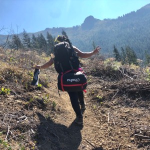
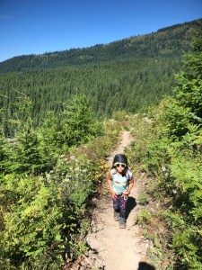
We arrived around 8:30am and parked at Grouse Vista Trail Head. There were already half a dozen cars there (next time, we come earlier). We crossed the street, and hiked up Grouse Vista Trail towards the split. Of course we used the toilet first and changed our shoes because we don’t ride in the car in our hiking boots.
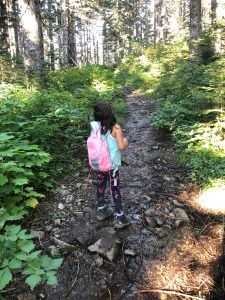
When we got to the split we took a left for the Tarbell trail because we really wanted to see the waterfall. The very first whine of the hike started pretty early because it was so gravelly. To distract we started the quest! If I recall correctly we were on a mission to save Princess Peach from Bowser (per usual) at the water castle (waterfall) and then we had a boss dragon battle a the summit to save Princess Zelda.
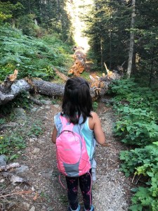
We pressed on! We reached a bridge that crossed Rock Creek. It’s a very nice bridge, but it was just a creek. Guess we hadn’t made it to the waterfall yet? So we kept going… which soon turned into quite the switchback climb. When we reached what seemed like the top of Tarbell after being in the sun for awhile, you took a slip. We had our first, and only, cry of the trip. You got a scrape but it was no match for my first aid kit! Luckily we were now across the gravel roads and into tree cover. Yay! Shade! That trail felt like an eternity of grueling incline of switchbacks thanks to the amount of direct, hot sun and loose gravel.
After crossing some gravel roads and figuring out where the trail continues on, we reached where Tarbell and Sturgeon meet. We also met some really sweet ladies and their dogs out for the day. This is what we’re going to call halfway to the waterfall because that’s what it felt like.
From here the path went downhill in multiple switchbacks and we were not excited about it being back in the sun. Incline with loose gravel is hard, but decline requires more attention because the possibility of slipping just increases. We could see the tree line waaaaay below which hopefully meant the waterfall was close. It wasn’t, but that’s probably because the sun was so hot so it felt so long. Only a couple slips occurred, but nothing that needed the first aid kit.
Eventually we got to a bridge crossing. We were stoked about seeing the waterfall! But it was so small… more like a creek… no falls? Well, the actual waterfall is at the second bridge crossing literally around the corner from the first bridge.
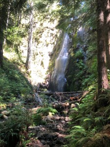
The waterfall was worth it, but the trek there was not easy-peasy-lemon-squeezy. I didn’t expect it to be, but I also didn’t expect that much exposure to direct hot sunlight.
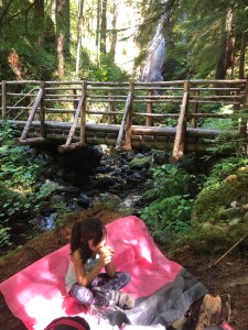
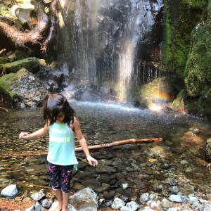
Once we got to the waterfall we parked our bums on a nearby fallen log and ate lunch. We didn’t have energy to do a dance… Two men also out there for the first time found a spot and set up camp. The thought crossed my mind that maybe camping here would be wonderful with the sounds of rushing water, but mom had to see the summit.
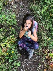
While we were there at the waterfall we met a couple riding their horses who also stopped for lunch. You were so excited by the horses and mesmerized by the giant sacks over their faces. You learned about feed bags and petted them.
Then, being your usual friendly self, you asked me if you could introduce yourself to another kid that was there with her family. Of course I said yes and you became fast friends. For the first time I watched you take off your shoes and wade through a creek looking for crawdads (you guys found one!) and salamanders and rocks. You are always so scared of creatures in the water that it was so nice to see you relax and just have fun.
When they had to go, we headed up towards Chinook Trail and Ed’s Trail thinking we’d take the ridgeline to the summit since it’s supposed to be stunning. So off we went. However, once we reached the ridgeline where it splits to Ed’s Trail we turned around. Why? Because Tarbell was already so exposed and you had bright red cheeks and I wasn’t sure how much more sun I should expose you to… plus there was a very intense drop to one side and the wind was picking up. We also ran into a couple who was surprised to see you (6yo) up there and told us a horrible story about how they lost their dog, leashed, over the side and how one of them almost went with it. This was enough for me to be convinced we should go back and try a different route. Turning to the printed map, it looked like Sturgeon would be our best, quickest bet… so we started back-tracking.
This turned into a great idea because we took a dip and cooled off before we went back up Tarbell into the sun towards the summit. It was almost 4pm at this point and I knew the sun would be hot hot hot. We soaked some bandanas in the cold water, wet our hair, and headed back up Tarbell towards Sturgeon Rock Trail.
I decided not to refill our water because I didn’t have a filter on me and our bladders were half full still, so logically I figured we’d make it fine. Plus, I read there was a spring near the summit that we never found. Anyways, that was a terrible idea.
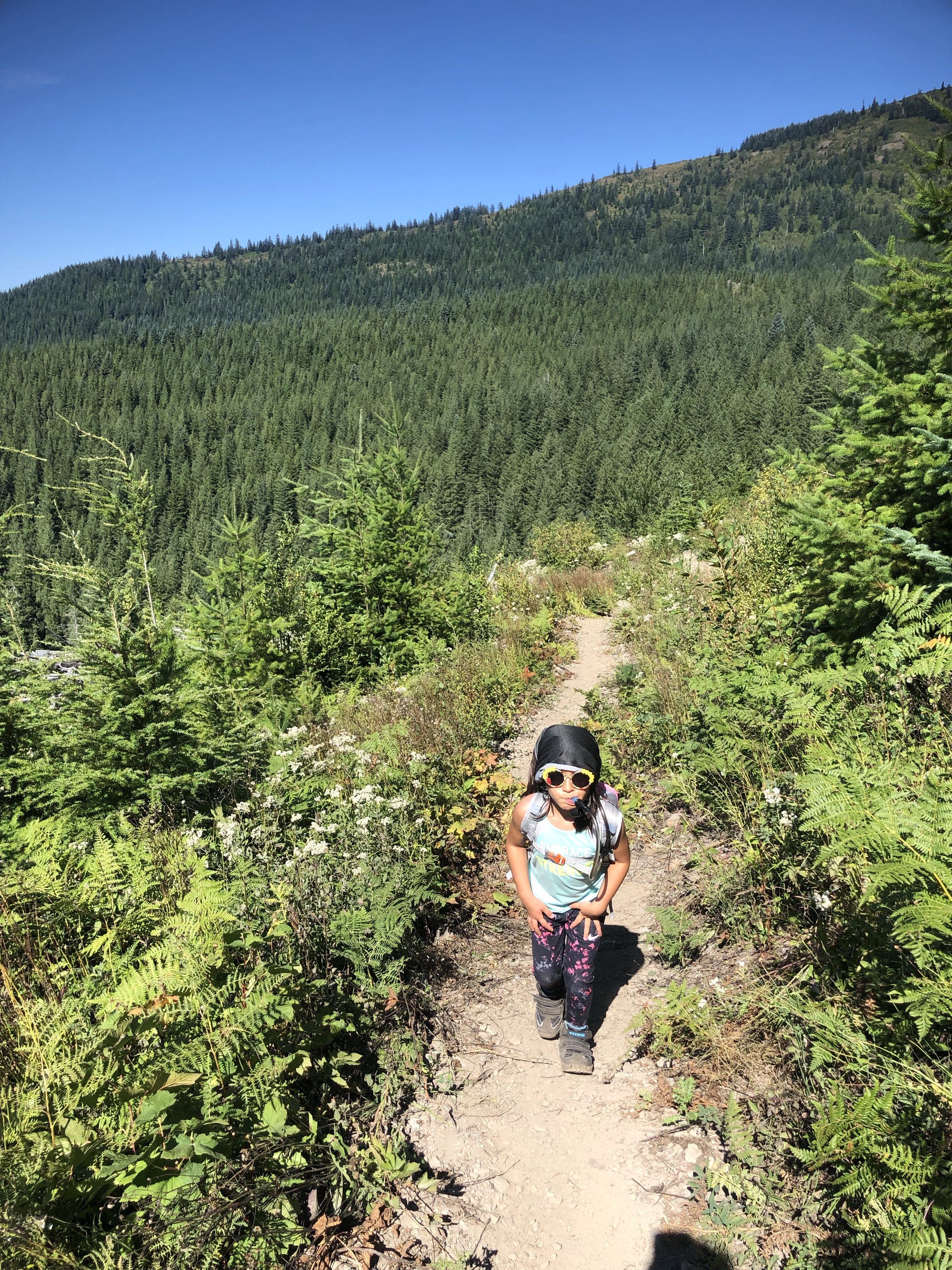
We thought Tarbell down towards the waterfall was grueling… well on the way up it was even worse. We went one hot section to a shady spot at a time (which shade was rare)… and couldn’t stop drinking water. It was so hot and so rocky and my fat little short thighs felt so tired… but we knew at the top the trail split and the trees would bring shade.
There was lots of whining and stopping for drinks of water. I re-soaked your bandana a few times too, which was probably not a good idea since we were trying to conserve water… but your little bright red cheeks made me do it. I would do anything for your comfort over my own.
Anyways, Sturgeon trail was even harder than any of the other trails. This could’ve been because it is a harder trail.. or it could’ve been because we were so tired at this point, the incline on this trail just hurt a lot. The trail is a very steady up, all rock, with dips and twists, and even some downed trees we had to climb over/under. We never even found the split to see the actual Sturgeon Rock, and due to our time crunch, I didn’t feel like looking around so we just pushed on. Up until this point we’d kept a pretty good steady pace, but the difficulty of this trail, plus the water consumption on Tarbell heading this way, and the sheer exhaustion of having gone over 15 miles at this point just made it difficult to push on – but we did. One tenth of a mile or so at a time….
You WOULD NOT shut-up about bears and snakes and it made me nervous too. I spent a lot of time looking over our shoulder thanks to that. Bears smell awful and you’d know if one was nearby.. plus I hadn’t seen any scat so I should’ve relaxed.
Anyways, this trail reminded me of a creek bed – very rocky and uneven – or a washed out road because I swear in some spots it looked like cars used to drive through there. Eventually we reached Grouse Vista Trail and rejoiced that we were close. Then came a large rock pile that looked like a sacrificial mound or alter or something. I guess it’s just the pile of rocks telling you that’s where all the trails meet before summit. Someone up there told me there was a fake summit and real summit as well… I never double checked to see which we were at, but we walked all over the place up there and judging by how many people we saw up there we figured we were in the right spot.
Right passed this pile was a big campsite already taken by a large family with hammocks up. They were so nice and we asked some questions about the spring. Nobody we asked while out there had heard of this spring.. but the last I read the station for it had gone biological and was removed (but the natural part that comes from the ground is supposed to be somewhere up there too about 1/3 mile from summit). That really nice family gave us a bottle of water when they realized we were out and told us that past the summit, which was super close, to the far right was a trail that went down into the trees that looked like a good camping spot.
We reached summit within five minutes. We looked for the spot over the hill down the trail, and there were already three tents down there. Not much else looked promising for a campsite unless you’re willing to sleep on gravel or tromp over wildflowers (and we don’t do that).


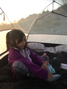
So we settled for right up by the summit on the ridge. It was gravel, but also nice and flat. We tried to put up our tent and learned quickly we couldn’t anchor with stakes because it was all rocks. I lost two stakes trying to hammer them into the ground. Our solution? We used the rocks as anchors instead because there is not a shortage of rocks of all sizes there.
We blew up our sleeping mattress with the air pump that doubles as its carrying case, and set up our bed. While doing this some teenagers walked by looking like they were heading out, so I said hi and asked if they were leaving. Turns out they were and they had 2 bottles of water to spare! We now had 3 bottles! Well two.. because as soon as we got the two new ones we split one and I’ve never seen you chug water so fast.
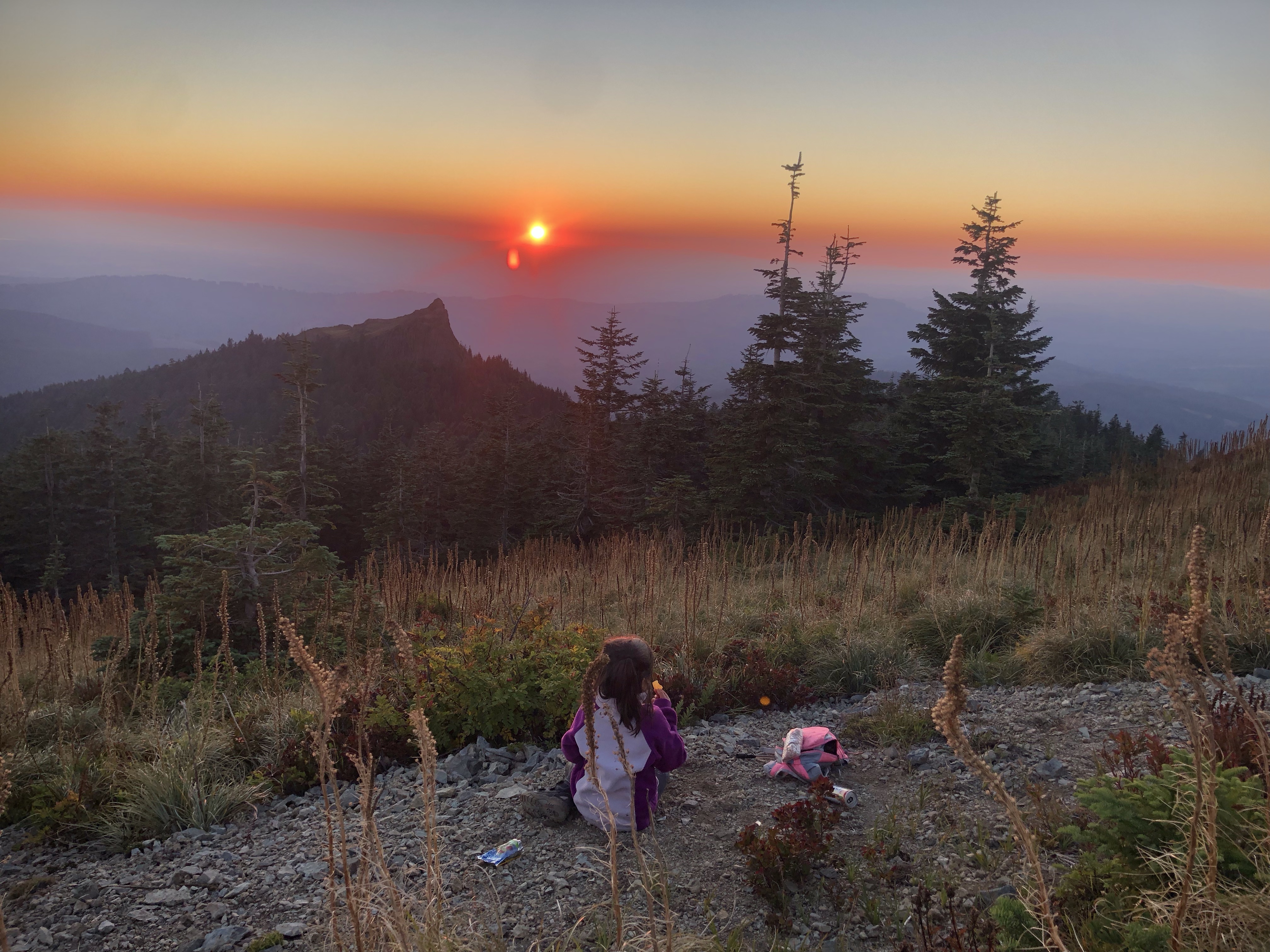

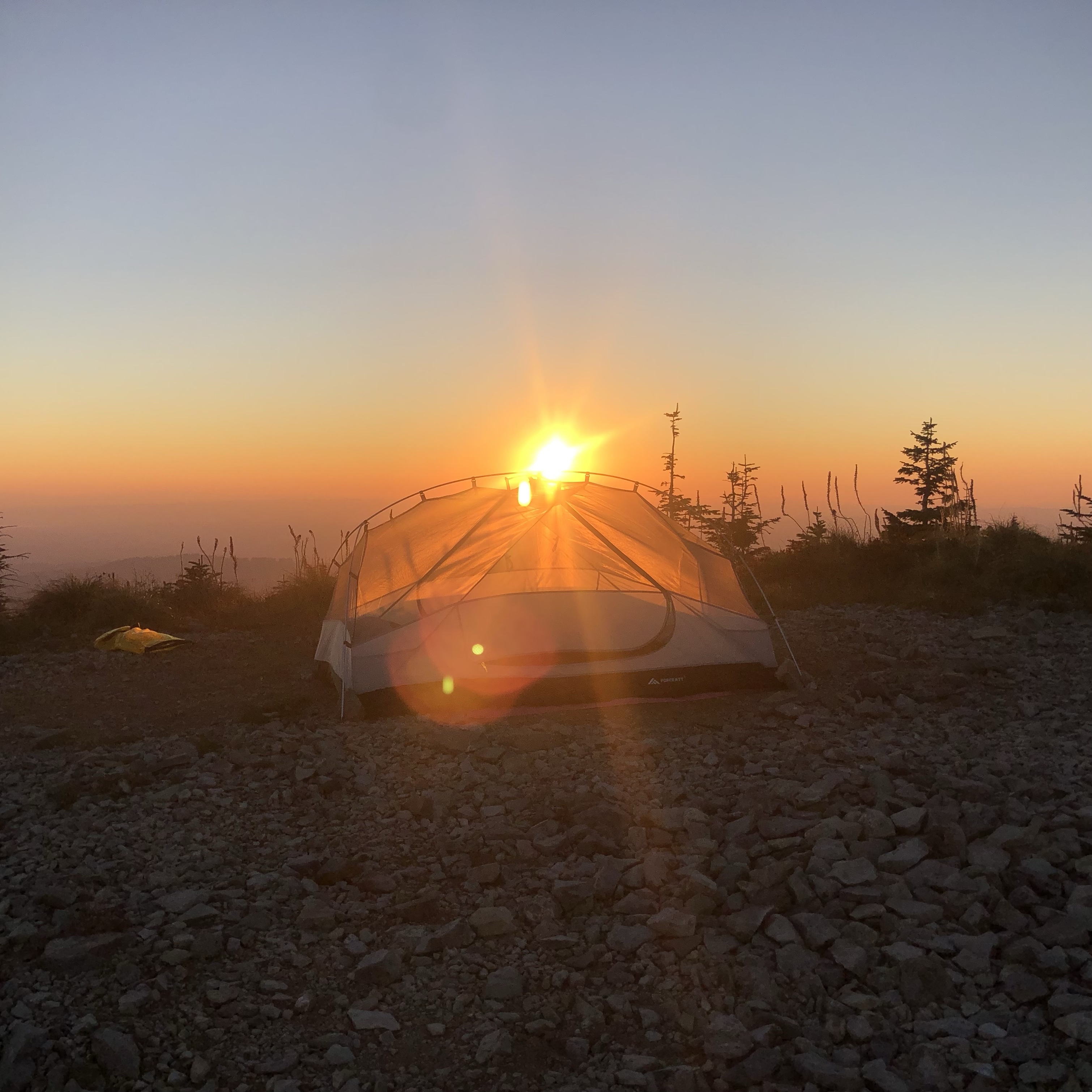
Once set up, we went behind our tent onto a gravel patch about 15 feet from our tent and ate dinner, enjoyed our summit prizes, and relaxed while the sun went down. We changed into our tent jammies and sealed up everything that we thought would attract animals into the dry bag and placed it over 100 paces away. We wanted to see the stars come out, and you really wanted to find the brightest star (your daddy), so I left the tent cover off until you fell asleep. You fell asleep before it was even completely dark.. you picked the brightest start you could find, yelled “HI DADDY!” then you were out like a light.
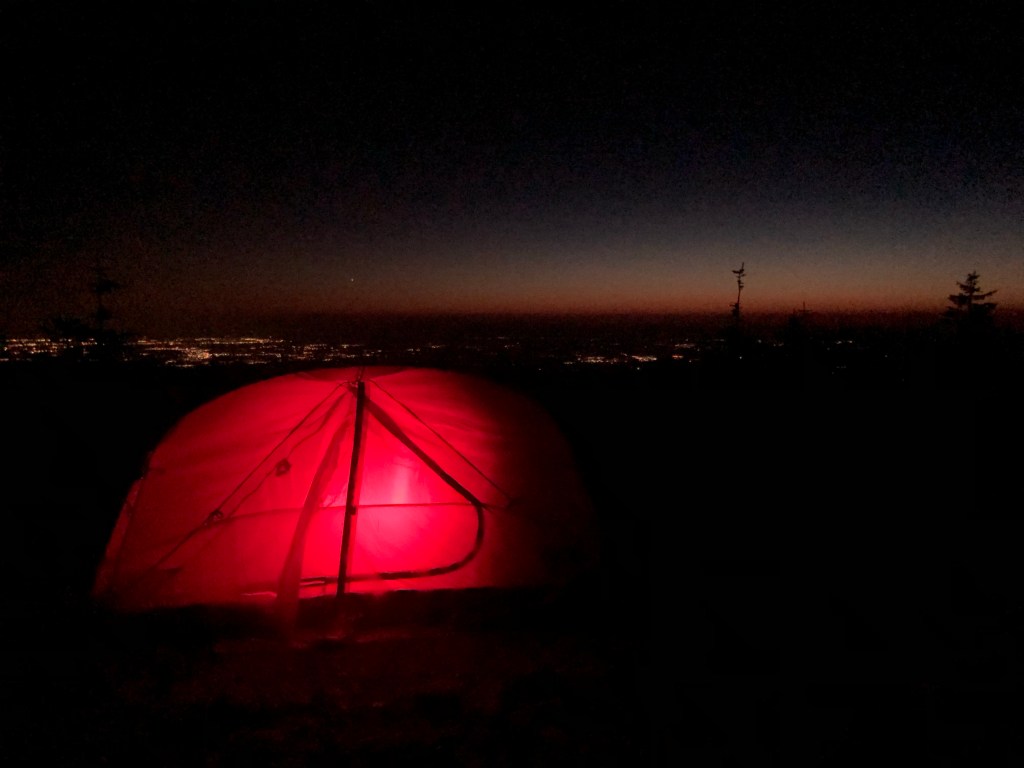
I stayed up a little longer and watched the stars by myself. Eventually it started to get really cold, and while I could still hear our neighbors having a good time, I got out and put the cover on our tent.
You missed a cool sight: all the lights of Portland and Vancouver on one side of the mountain, while the other side was just darkness and endless stars. If I had a better camera I could’ve taken some really cool pictures of the night sky… I guess we’ll just have to do this again.
After the cover went up I started to notice the wind for the first time. It would gust every once in awhile and cause the rocks we were using as anchors to shift a little (I used enough rocks I knew it wasn’t going anywhere). The wind would also cause all the gravel around us to shift. It sounded like an animal was moving around outside our tent. All night I played that game when the wind gusted: is it wind or an animal?? Between this thought and my need to pee… I couldn’t fall asleep.
Then at 2am someone drove a four-wheeler up to summit making a lot of noise and because I knew it would scare any animals around away… I finally fell asleep. Yes, I was terrified all night, and even though I found comfort knowing we had neighbors nearby, it wasn’t enough to help me sleep. I know that animal encounters are rare, and being inside a tent gave us a little more protection than not, but I also remembered I’d read people hunt bears in the area (no idea if that’s true). So my mind raced all night.
Hopefully this was just first night, first experience jitters. I hope I sleep better the next time we try this.

Eventually daylight started to creep in and the sun started to follow so I ran outside and peed down a trail somewhere a ways from our tent. Then I woke you up and we ate breakfast. Since we weren’t staying another night, we just curled up in the sleeping bag and ate inside the tent.
After breakfast we went and took some pictures on the summit then tore down our set up. We took Grouse Vista Trail all the way back to the parking lot without veering or exploring because we were tired and wanted to go home. We all have our limits, and even though this was everything we had hoped for, we had reached our limit as first timers. The trip back felt super fast.
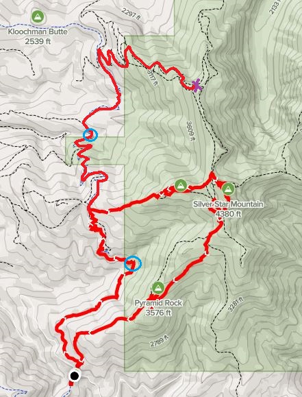
Our Trek:
- Black dot is Grouse Vista TH parking lot
- Blue circles mark creek/waterfall crossings. The first circle is rock creek, second circle is actually two bridge crossings: a creek first and then you reach Hidden Falls just around the corner from it
- Purple X is where we turned around
- Our entire trip clocked in at around 20 miles and 4100′ elevation gain. We did 16.5 miles the first day (or so my step counter said)
A word of caution to this tale: I do not recommend relying on my word alone for your research prior to starting a hike or going backpacking. Please take all precautions to do the activity safely and knowledgeably. I am not liable for your choices on your hikes/camp outs. I can only inform and entertain based on my own experience.

Leave a comment